Merowe, Sudan

Merowe, Sudan
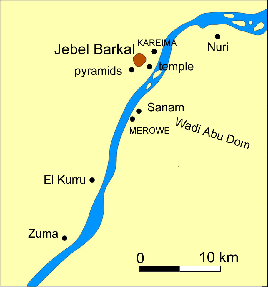
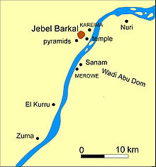
Map of Jebel Barkal and Merowe

Merowe is a town known to hold Merowe Dam project in Northern State in Sudan some 380 km from khartoum next to Karima Town.

Transport

Merowe is served by a branch of the national railway network.

See also

References

Coordinates: 18°29′00″N 31°49′00″E / 18.4833333°N 31.8166667°E / 18.4833333; 31.8166667


Wikimedia Foundation. 2010.

Игры ⚽ Нужен реферат?

Look at other dictionaries:

  • Merowe Dam — Merowe Dam …   Wikipedia

  • Merowe-Damm — Merowe Staudamm Lage: Sudan Zuflüsse: Nil Abflüsse: Nil …   Deutsch Wikipedia

  • Merowe-Hamadab-Damm — Merowe Staudamm Lage: Sudan Zuflüsse: Nil Abflüsse: Nil …   Deutsch Wikipedia

  • Merowe-Staudamm — Lage …   Deutsch Wikipedia

  • Merowe-Talsperre — Merowe Staudamm Lage: Sudan Zuflüsse: Nil Abflüsse: Nil …   Deutsch Wikipedia

  • Merowe — may refer to: Meroe or Meroë, a town downstream from the bend between the north and south flowing reaches of the Nile between the 3rd and 4th Cataracts, in the Sudan, that is the site of over 200 pyramids, Merowe, Sudan, a town upstream from the… …   Wikipedia

  • Merowe Airport — IATA: MWE – ICAO: HSMR Summary Serves Merowe Location …   Wikipedia

  • Hamadab-Merowe-Damm — Merowe Staudamm Lage: Sudan Zuflüsse: Nil Abflüsse: Nil …   Deutsch Wikipedia

  • Sudan — This article is about the country. For the geographical region, see Sudan (region). For the state that seceded from Sudan, see South Sudan. For other uses, see Sudan (disambiguation). Republic of the Sudan جمهورية السودان Jumhūrīyat as Sūdān …   Wikipedia

  • Sudan — Republic of Sudan (englisch) جمهورية السودان (arabisch) Dschumhūriyyat as Sūdān (Umschrift) Republik Sudan …   Deutsch Wikipedia

Share the article and excerpts

Direct link
Do a right-click on the link above
and select “Copy Link”