- Medicine Butte
-
Medicine Butte 
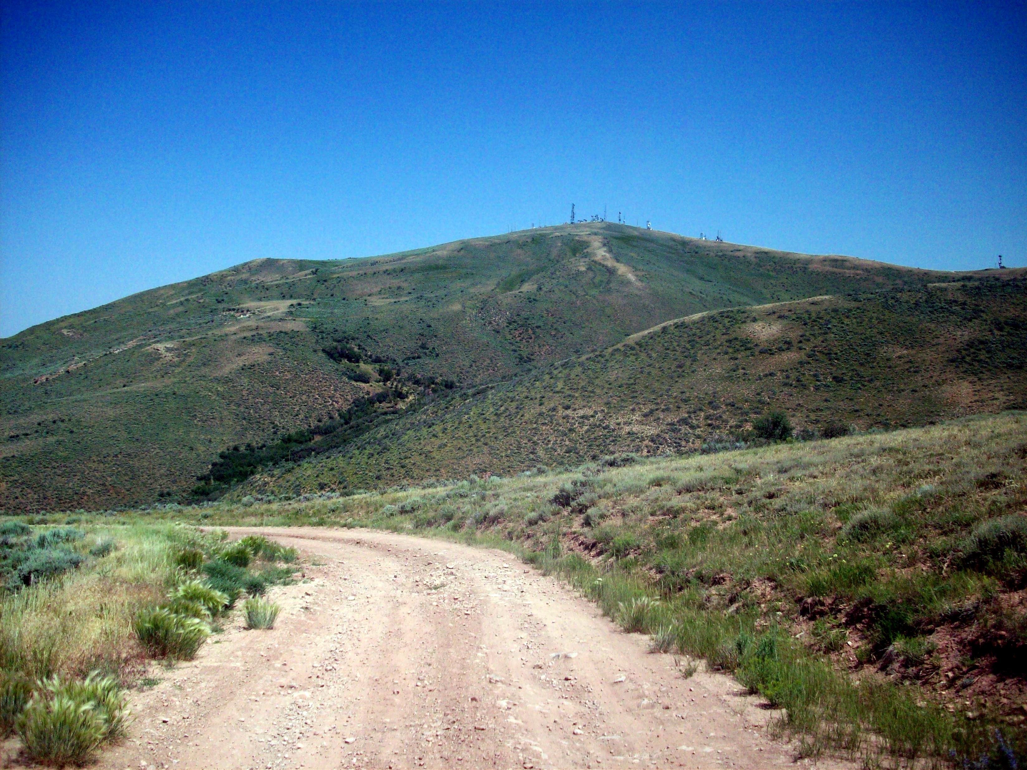
Medicine Butte, as seen from the south, looking north.Elevation 8,610 ft (2,624 m) Location Location Uinta County, Wyoming Range Uinta Mountains Coordinates 41°21′08.42″N 110°54′28.8″W / 41.3523389°N 110.908°W Climbing Easiest route Access road  Looking to the southeast from Medicine Butte
Medicine Butte is a mountain located in Uinta County, approximately 6.9 miles (11 km) north of the city of Evanston, Wyoming. It is 8,610 feet (2,624 m) in elevation and can be reached via an access road. The mountain houses radio towers serving numerous local and regional services.
The mountain is named as such by Native Americans because of the great variety of herbs and roots that the they used for medicine which were found on the slopes of the butte. The mountain is sometimes known as “Fremont’s Monument” for John C. Fremont.[1]
Contents
Radio use
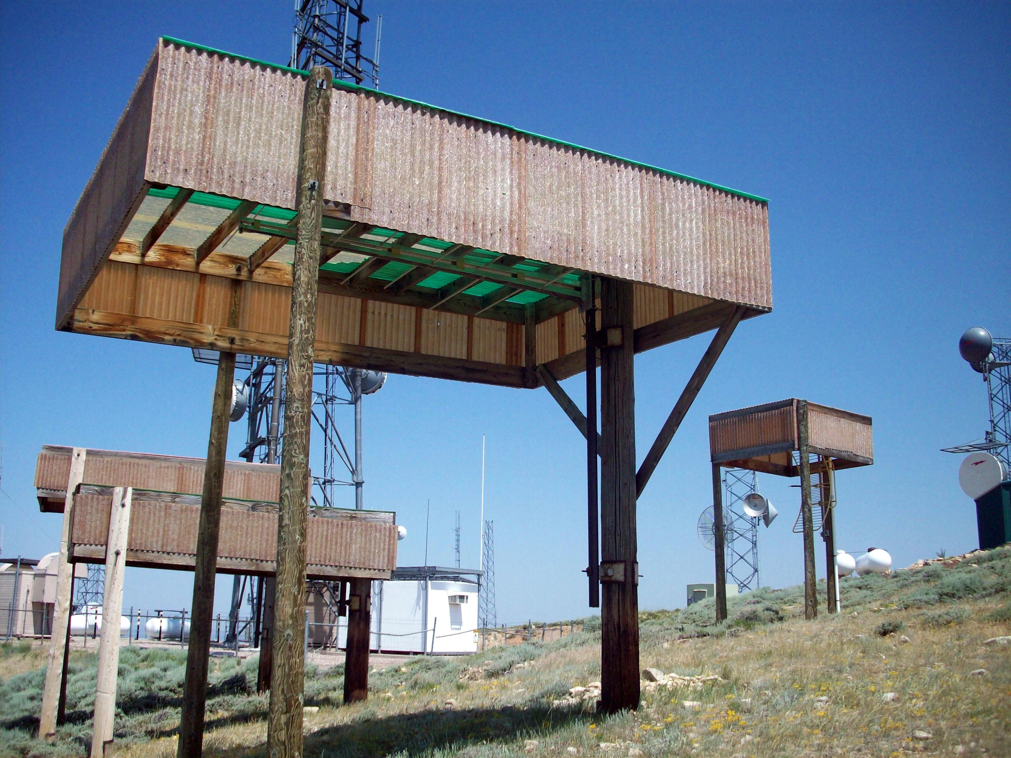
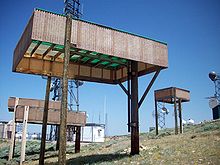 Radio transmitters on the mountain. The structures protect them from snow damage.
Radio towers for several different communications systems exist on the summit of the mountain. Most notable of these are two higher power FM radio stations, and numerous translators serving the local area. The following is a complete list of radio stations with transmitters located on the mountain, sorted by frequency.
CALLSIGN FREQUENCY FORMAT KPMD 88.1 National Public Radio (satellite of KPCW) K209DC 89.1 Religious radio K240CP 95.9 Christian contemporary K252AI 98.3 Classic Hits (KRSP) KNYN 99.1 Variety As well as housing towers and transmitters for radio stations, the mountain also has towers for amateur radio operations. It is owned by a resident from Manila, Utah and transmits on 146.680 MHz. Another amateur radio repeater nearby, transmits on 147.02 MHz. It is known as K70GM.[3] Local companies and telecommunications services also carry towers on the mountain. Emergency systems for Evanston and Uinta County also broadcast from towers on Medicine Butte. Daggett County, Utah also has services transmitting from the mountain. The United States Forest Service owns a tower on the mountain.[4]
KNYN
 KNYN's temporary tower (center)
KNYN is the highest power radio station transmitting on the mountain. In 2005, the station suffered a partial tower collapse and has been running on lower power (and a backup transmitter) since. The cause of the collapse was apparently weather related, as the area had experienced heavy icing.[5][6]
Television
Medicine Butte is commonly used to receive television signals from the Salt Lake City market, and relay them into rural parts of Wyoming and Idaho. The following is an incomplete list of television stations broadcasting from Medicine Butte to the surrounding area.
CALLSIGN CHANNEL NETWORK K15FR 15 PBS K23DS-D 23 Wyoming Public Television K28DV 28 The CW K32DS 32 Wyoming Public Television K50DR 50 Independent K54EH 54 Wyoming Public Television Access
Medicine Butte can be accessed via Red Willow Road, north of Evanston on US Highway 89. The road is used locally for the landfill of Evanston, but branches off to the left to climb the summit. The road is not in good condition in most places, and a four wheel drive vehicle is recommended.[8]
References
- ^ Wyoming Places Wiki - Medicine Butte
- ^ Radio stations in Evanston, Wyoming
- ^ The Medicine Butte Repeater (Utah VHF Society)
- ^ Bureau of Land Management Communications Site
- ^ Evanston Tower sites - Fybush.com
- ^ KNYN tower collapse
- ^ FCC TV Query - Evanston, Wyoming
- ^ Medicine Butte - Peakbaggeer.com
Categories:- Mountains of Wyoming
- Geography of Uinta County, Wyoming


Wikimedia Foundation. 2010.