- Matachí Municipality
-
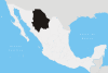
Matachí — Municipality — Municipality of Matachí in Chihuahua Location in Mexico
 Matachí
Coordinates: 28°50′33″N 107°34′50″W / 28.8425°N 107.58056°WCoordinates: 28°50′33″N 107°34′50″W / 28.8425°N 107.58056°W Country  Mexico
State Chihuahua Municipal seat Matachí Founded November 21, 1844 Area – Total 829.8 km2 (320.4 sq mi) Population (2005) – Total 3,169 Matachí is a one of the 67 municipalities of Chihuahua, in northern Mexico. The municipal seat lies at Matachí. The municipality covers an area of 829.8 km².
As of 2005, the municipality had a total population of 3,169.[1]
Geography
Towns and villages
The municipality has 28 localities. The largest are:
Name Population Matachí 1,745 Tejolocachi 395 Ejido Buenavista 386 Total Municipio 3,169 References
- ^ "Matachí". Enciclopedia de los Municipios de México. Instituto Nacional para el Federalismo y el Desarrollo Municipal. http://www.e-local.gob.mx/work/templates/enciclo/chihuahua/Mpios/08043a.htm. Retrieved October 25, 2008.
 State of Chihuahua
Cities Ciudad Chihuahua • Ciudad Cuauhtémoc • Ciudad Juárez • Delicias • Parral
Municipalities Sights Categories:- Municipalities of Chihuahua
- Chihuahua geography stubs


Wikimedia Foundation. 2010.