Urandangi

Urandangi
Urandangi
Queensland
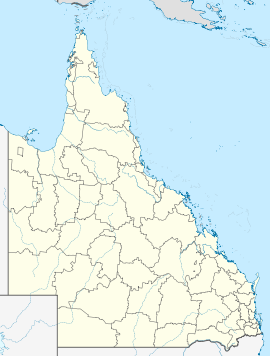
Urandangi is located in Queensland
{{{alt}}}
Urandangi
Postcode: 4824
Coordinates: 21°36′30″S 138°18′51″E / 21.60833°S 138.31417°E / -21.60833; 138.31417Coordinates: 21°36′30″S 138°18′51″E / 21.60833°S 138.31417°E / -21.60833; 138.31417
Location:
  • 2007 km (1,247 mi) NW of Brisbane
  • 187 km (116 mi) SW of Mount Isa
  • 159 km (99 mi) W of Dajarra
LGA: Shire of Boulia
State District: Mount Isa
Federal Division: Kennedy

Urandangi is a town in north-western Queensland, Australia. The town is located on the banks of the Georgina River and in the Shire of Boulia local government area, 2,007 kilometres (1,247 mi) north west of the state capital, Brisbane and 187 kilometres (116 mi) south west of the regional centre of Mount Isa.

The township was founded in 1885 as a centre for travellers and drovers where a stock route crossed the Georgina River. By 1920 Urandangi had a pub, two stores, post office, police station and a dance hall.[1] Today, Urandangi's only major facility is the Urandangi Hotel or the "Dangi Pub".[2]

The Marmanya Aboriginal community is located in Urandangi.[3]

References

  1. ^ "Queensland's Outback: Urandangi". Queensland Holidays. Tourism Queensland. http://www.queenslandholidays.com.au/destinations/outback/places-to-visit/urandangi/. Retrieved 6 November 2010. 
  2. ^ Anderson, John (4 May 2010). "Urandangi gateway to anywhere". Townsville Bulletin. http://www.townsvillebulletin.com.au/article/2010/05/04/135335_hpopinion.html. Retrieved 6 November 2010. 
  3. ^ Anderson, John (17 May 2010). "The voice not heard". Townsville Bulletin. http://www.townsvillebulletin.com.au/article/2010/05/17/138931_news.html. Retrieved 6 November 2010. 

External links


Wikimedia Foundation. 2010.

Игры ⚽ Поможем решить контрольную работу

Look at other dictionaries:

  • Woodroffe River — Gordon CreekVorlage:Infobox Fluss/GKZ fehlt Lage Northern Territory / Queensland (Australien) Flusssystem Warburton River Abfluss über …   Deutsch Wikipedia

  • Plenty Highway — Infobox Australian Road |type = road road name = Plenty Highway route route route photo = caption = length = 492 direction = West East start = finish = Donohue Highway, Tobermorey Homestead, Northern Territory NT/Qld Border est = through =… …   Wikipedia

  • Boulia Shire Council — Infobox Australian Place | type = lga name = Boulia Shire Council state = qld imagesize= 180 caption = Location in Queensland pop = 640 (2001 census) area = 61176 est = seat = Boulia mayor = Trevor Jones region = url =… …   Wikipedia

  • Boulia Shire Council — Lage des Boulia Shire in Queensland Gliederung …   Deutsch Wikipedia

  • Comte de Boulia — Comté de Boulia Comté de Boulia Géographie État : Queensland Région  …   Wikipédia en Français

  • Comté De Boulia — Géographie État : Queensland Région  …   Wikipédia en Français

  • Comté de Boulia — 22° 54′ S 139° 54′ E / 22.9, 139.9 …   Wikipédia en Français

  • Comté de boulia — Géographie État : Queensland Région  …   Wikipédia en Français

  • Georgina River — im Einzugsgebiet des Lake Eyre DatenVorlage:Infobox Fluss/GKZ fehlt …   Deutsch Wikipedia

  • black stump — The black stump of Australian legend first appears in 1954, and is an imaginary marker at the limits of settlement: Head west of the Black Stump, sail right past Woop Woop, keep on going and finally you might hit Urandangi, the town without a… …   Australian idioms

Share the article and excerpts

Direct link
Do a right-click on the link above
and select “Copy Link”