- Mariemont Historic District
-
Mariemont Historic DistrictThe Mariemont Inn
Location: Mariemont, Ohio Area: 3,190 acres (12.9 km2) Architect: John Nolen [1] Architectural style: American colonial and Greek Revival[1] Governing body: Local and Private[1] NRHP Reference#: 79001862[1] Added to NRHP: July 24, 1979[1] Village of MariemontLocation: Mariemont, Ohio Built: 1920 Architect: Nolan;Emery;Livingwood;Anderson,G.; Atterbury;Cellarius;Dana;Howe, et.al Architectural style: Late 19th And 20th Century Revivals, Late 19th And Early 20th Century American Movements Governing body: Local NRHP Reference#: 07000431 Significant dates Added to NRHP: March 29, 2007[1] Designated NHLD: December 5, 2006[2] Mariemont Historic District and Village of Mariemont are one or two overlapping historic districts in Mariemont, Ohio.
Mariemont Historic District was listed in the National Register of Historic Places on July 24, 1979. It contains 180 contributing buildings. These include single and multiple dwellings and businesses.
Village of Mariemont, which may be just a part, or may be exactly the same district, was designated a National Historic Landmark in 2006, and it, or an extension, was listed on National Register in 2007.
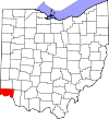
Mariemont itself is a planned community village in Hamilton County, Ohio, United States. Founded in the 1920s by Mary Emery, Mariemont exhibits English architecture from Norman to classic Georgian style. Several parks exist in the village, including the Concourse on Miami Bluff Drive and Dogwood Park, which houses the memorial carillon, offering concerts on Sundays throughout the summer months. The village square serves as the community center with red brick Tudor buildings, including the Mariemont Inn and historical Mariemont Barber Shop. Mariemont also has one of the few elected Town Criers remaining in North America.
On December 5, 2006, the Village of Mariemont was designated a National Historic Landmark.[2]
On March 29, 2007, the Mariemont Historic District was designated a National Historic Landmark.[3]
It is located on U.S. Route 50. It borders both sides of US 50, bounded by Westover industrial section, Beech St., Murray and Grove Aves., and the Little Miami River.[3]
See also
Notes
- ^ a b c d e f "National Register Information System". National Register of Historic Places. National Park Service. 2007-06-30. http://nrhp.focus.nps.gov/natreg/docs/All_Data.html.
- ^ a b "Mariemont Historic District". National Historic Landmark summary listing. National Park Service. http://tps.cr.nps.gov/nhl/detail.cfm?ResourceId=1701339393&ResourceType=District. Retrieved 2008-06-16.
- ^ a b National Park Service websites support both dates. One must be wrong, or the second one indicates an increase to the historic district area. Second date supported by this NPS new listing.
Archaeological sites on the National Register of Historic Places in Hamilton County, Ohio Benham Mound | Betts-Longworth Historic District | Burchenal Mound | Clough Creek and Sand Ridge Archeological District | Colerain Works Archeological District | Conrad Mound Archeological Site | Dravo Gravel Site | Dunlap Archeological District | Hahn Field Archeological District | Mariemont Embankment And Village Site | Mariemont Historic District | Mathew Mound | Mt. Nebo Archaeological District | Odd Fellows' Cemetery Mound | Perin Village Site | Norwood Mound | Rennert Mound Archeological District | Shawnee Lookout Archeological District | Short Woods Park Mound | State Line Archeological District | Story Mound | Turpin Site | Wesley Butler Archeological District
Keeper of the Register · History of the National Register of Historic Places · Property types · Historic district · Contributing property Categories:- Historic districts in Ohio
- National Historic Landmarks in Ohio
- Historic districts in Hamilton County, Ohio
- Ohio Registered Historic Place stubs
Wikimedia Foundation. 2010.

