- Marie-Galante Airport
-
Marie-Galante Airport IATA: GBJ – ICAO: TFFM Summary Airport type Public Operator Conseil Général de la Guadeloupe Serves Grand-Bourg, Marie-Galante, Guadeloupe Elevation AMSL 17 ft / 5 m Coordinates 15°52′07″N 061°16′20″W / 15.86861°N 61.27222°WCoordinates: 15°52′07″N 061°16′20″W / 15.86861°N 61.27222°W Map Location in Guadeloupe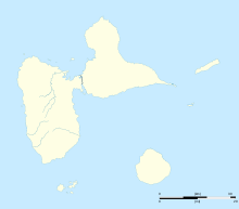
 TFFM
TFFMRunways Direction Length Surface m ft 09/27 1,240 4,068 Asphalt Sources: AIP,[1] Marie-Galante Airport (IATA: GBJ, ICAO: TFFM) is an airport serving the island of Marie-Galante in Guadeloupe.[1] It is located 5.5 km (3.0 NM) east of Grand-Bourg,[1] one of three communes on the island.
Facilities
The airport resides at an elevation of 17 ft (5 m) above mean sea level. It has one paved runway designated 09/27 which measures 1,240 × 30 m (4,068 × 98 ft).[1]
References
- ^ a b c d TFFM – Marie Galante (PDF). AIP from French Service d'information aéronautique, effective 17 Nov 2011.
External links
Categories:- Airports in Guadeloupe

Wikimedia Foundation. 2010.