- Maragüez
-
Barrio Maragüez Location of barrio Maragüez within the municipality of Ponce shown in red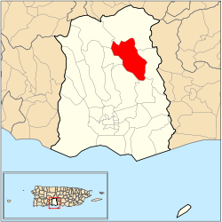
Country  United States
Territory  Puerto Rico
Municipality  Ponce
PonceArea – Total 6.42 sq mi (16.6 km2) – Land 5.31 sq mi (13.8 km2) – Water 1.11 sq mi (2.9 km2) Population (2000) – Total 754 – Density 142/sq mi (54.8/km2) Source: 2000 Census Maragüez (Barrio Maragüez) is one of the 31 barrios of the municipality of Ponce, Puerto Rico. Along with Magueyes, Tibes, Portugués, Monte Llano, Machuelo Arriba, Sabanetas, and Cerrillos, Maragüez is one of the municipality's eight rural interior barrios.
Contents
Location
Maragüez is a rural barrio located in the northeastern section of the municipality, northeast of the city of Ponce at latitude 18.106178 N, and longitude -66.595986 W. [1]
Boundaries
It is bounded on the North by barrios Anón and San Patricio, in the South by barrio Cerrillos, in the West by barrios Monte Llano and Machuelo Arriba, and in the East by barrios Anón and Real.Río Cerrillos runs a large stretch of its course through barrio Maragüez, and is known locally (and unofficially) as Rio Maragüez.
Features and demographics
 Puerto Rico Highway 139 (PR-139) in Barrio Maraguez, heading South-bound, with the City of Ponce and the Rio Portugues channel in the background and the Caribbean Sea in the far background
In 1920 Maragüez had a population of 616 inhabitants.[2] By 2000, the population of Maragüez had grown to only 754 persons, making it the fourth least populated barrio of the municipality after 80 years.[3] At 142 persons per square mile, Maragüez is also the fourth least densely populated barrio in the municipality.[4] The main road serving barrio Maragüez is PR-139.[5]
The highest point in Barrio Maragüez stands at 2,132 feet and is located at the extreme northeast tip of the barrio. Another notable land feature is the Cerro Santo Domingo which stands at 2,004 feet.[6]
Landmarks
The Cerrillos Dam over Río Cerrillos is located in barrio Maraguez.[7] Cerrillos Lake is located in Barrio Maragüez.
Coordinates: 18°06′02″N 66°35′28″W / 18.1006415°N 66.5911700°W[8]
References
- ^ City Melt Retrieved, March 21, 2010.
- ^ 1920 Census
- ^ Ponce, Puerto Rico: Barrios. Areciboweb. Retrieved, February 14, 2010.
- ^ U.S. Census Bureau. Census 2000. Ponce and Its Barrios. (Ponce Municipio, Puerto Rico -- County Subdivision and Place. GCT-PH1. Population, Housing Units, Area, and Density: 2000. Data Set: Census 2000 Summary File 1 (SF 1) 100-Percent Data) Retrieved February 26, 2010.
- ^ General Purpose Population Data, Census 2000. Unidad de Sistemas de Información Geográfica, Área de Tecnología de Información Gubernamental, Oficina de Gerencia y Presupuesto. Gobierno de Puerto Rico. Retrieved February 22, 2010.
- ^ Maptest. Government of the Commonwealth of Puerto Rico. General Purpose Population Data, Census 2000. Unidad de Sistemas de Información Geográfica, Área de Tecnología de Información Gubernamental, Oficina de Gerencia y Presupuesto. Gobierno de Puerto Rico. Retrieved 10 November 2011.
- ^ Cerrillos Dam Retrieved March 21, 2010.
- ^ U.S. Geological Survey Geographic Names Information System: Maragüez Barrio
Categories:- Barrios of Ponce


Wikimedia Foundation. 2010.