- Maple Leaf, Seattle
-
 Maple Leaf
Maple Leaf is a mostly residential neighborhood in Seattle, originally a rural suburb (subdivided c. 1894) named Maple Leaf Addition to the Green Lake Tract or Green Lake Circle. The name may have come from the Maple Saw Mill that operated to the east on Lake Washington or from maple trees that once grew in the area,[1] though a popular story is that in the early days of Seattle's settlement the neighborhood was "so far north, it might as well have been Canada", and was named "Maple Leaf" as an inside joke.
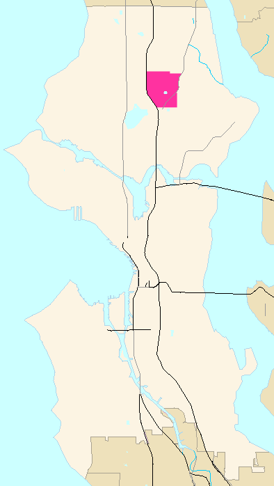
The original plat is located between what would later be named NE 85th and 105th Streets and 5th and 25th Avenues NE.[2] It was annexed to Seattle in the early 1950s.[3]. Although Seattle neighborhood boundaries are unofficial, the current approximate neighborhood boundaries are, starting from the south and working clockwise, NE 75th Street west to Banner Way NE, north on Banner Way to Interstate 5, then north along the edge of I-5 up to NE 103rd. Then east along NE 103rd to 5th Avenue NE, north to Northgate Way, then east to Roosevelt Way NE. South along Roosevelt to Thornton Creek and then east along the creek bed to Lake City Way NE (roughly at NE 98th). Then south along Lake City Way NE to 75th Ave NE map.
Maple Leaf is bordered on the south by the Roosevelt neighborhood; to the north by Pinehurst and Victory Heights neighborhoods of the Northgate district; to the east by the Lake City and Wedgwood neighborhoods; and to the west by the North College Park or Licton Springs neighborhood, map. (Seattle neighborhoods boundaries are informal).[4]
Maple Leaf is home to approximately 20,000 residents, mostly residing in "classic Seattle boxes",[5] (so initially a pejorative, wryly belied today by their high quality and prices), known locally as Seattle bungalows and Tudoresque style houses.[6] Since 2000 the Maple Leaf area has been undergoing considerable renovation as smaller, older homes sitting on 1/8 acre lots are being bulldozed to make room for new high-end "Craftsman"-style homes and, especially along Roosevelt Way NE from Snappy Dragon to Walgreens, townhomes.
Besides Northgate Mall (1950),[7] most of the businesses within Maple Leaf line Roosevelt Way NE from NE 75th to 100th Streets and 5th Avenue NE from NE 85th to 90th Streets. Notable neighborhood meeting spots on Roosevelt include Cloud City Coffee at 88th, family-owned Maple Leaf Ace Hardware at 91st, Judy Fu's Snappy Dragon at 90th, The Roosevelt Alehouse at 89th, the Reservoir Bar at 85th, and the Maple Leaf Grill at 92nd, while neighborhood meeting spots on 5th Avenue NE include Cafe Javasti and the San Marco Grocery at 84th. Cabinetworks on Roosevelt is long-established and one of the few woodworking manufacturers remaining in Seattle.
Distinctive features of the neighborhood include the water tower and reservoir located at 85th and Roosevelt, plus historic Waldo Hospital at 85th NE and NE 15th. The water tower is painted with a distinctive coupling of maple leaves viewable from Interstate 5. Across Roosevelt Way from the water tower and reservoir is Saint Catherine's School and Church. Just south is The Fairview Church and The Fairview School, one of the largest private primary schools in the city. Waldo Hospital was previously occupied by Camp Fire Boys and Girls.
Maple Leaf is one of two homes for a flock of feral conures (parrots) descended from escaped pets. They fly between Maple Leaf and Seward Park.[8]
The highest point in Maple Leaf, located on 91st Street between Roosevelt Way and 5th Avenue, is over 500 feet (150 m) in elevation, one of the highest points in the city. (High Point in West Seattle is 20 feet (6.1 m) higher.)[citation needed]
References
- ""About the Seattle City Clerk's On-line Information Services"". Information Services. Seattle City Clerk's Office. Revised 2006-04-30. http://clerk.ci.seattle.wa.us/~public/about.htm. Retrieved 2006-05-21.
See heading, "Note about limitations of these data". - Lange, Greg (2001-05-16). ""Seattle beginnings: Maple Leaf Post Office opens on August 21, 1889"". HistoryLink.org Essay 3279. http://www.historylink.org/essays/output.cfm?file_id=3279. Retrieved 2006-04-21.
Lange referenced Guy Reed Ramsey, Postmarked Washington, 1850-1960, microfilm (Olympia: Washington State Library, February, 1966), p. 622. - ""Maple Leaf"". Seattle City Clerk's Neighborhood Map Atlas. Office of the Seattle City Clerk. n.d., map .jpg c. 2002-06-17. http://clerk.ci.seattle.wa.us/~public/nmaps/html/NN-1038S.htm. Retrieved 2006-04-21.
Maps "NN-1030S", "NN-1040S".jpg dated 17 June 2002.
Note caveat in footer. - ""Maple Leaf History: A Bit of History in Leaps and Bounds"". City of Seattle. http://www.mapleleafcommunity.org/w-w-w_page.html#history. Retrieved 2006-04-21.
No sources listed on web page, so[citation needed]. Maple Leaf Community Council, PO Box 75595, Seattle, WA 98175-0595. - ""Northgate"". Seattle City Clerk's Neighborhood Map Atlas. Office of the Seattle City Clerk. n.d., map .jpg 2002-06-17. http://clerk.ci.seattle.wa.us/~public/nmaps/html/NN-1030S.htm. Retrieved 2006-04-21.
Note caveat in footer. - ""Parrots"". BirdWeb, Seattle Audubon Society. 2005. http://birdweb.org/birdweb/family_details.aspx?sci_name=Psittacidae. Retrieved 2006-04-21.
- Reynolds, Malvina (1963 Schroder Music Co.). ""Little Boxes"". Lieder mit Midi Melodies. http://ingeb.org/songs/littlebo.html. Retrieved 2006-04-21.
Original lyrics.
Copyright info - Wilma, David (2001-07-20). ""Seattle Neighborhoods: Maple Leaf -- Thumbnail History"". HistoryLink.org Essay 3454. http://www.historylink.org/essays/output.cfm?file_id=3454. Retrieved 2006-04-21.
Wilma referenced Mimi Sheridan and Carol Tobin, Licton Springs History, (Seattle: Licton Springs Community Council, 2001), 8;
Don Sherwood, "Sacajawea P.F.", in "Interpretive Essays of the Histories of Seattle's Parks and Playfields", handwritten bound manuscript dated 1977, Seattle Room, Seattle Public Library. - Wilson, Kimberly A. C.. ""Neighborhood is another one of Seattle's best-kept secrets"". Seattle Post-Intelligencer. Seattle Post-Intelligencer. http://www.seattlepi.com/neighbors/mapleleaf/. Retrieved 2006-09-30.
Note esp. the 75th Street border.
Notes
- ^ (1) Wilma. (Also name as "Green Lake Tract".)
(2) "Green Lake Circle", Lange - ^ Although the "Seattle City Clerk's Neighborhood Map Atlas" (see also the following note) still refers to 85th Street as the lower boundary of Maple Leaf, the Maple Leaf Community Council uses 75th as the lower boundary. The City of Seattle's Department of Neighborhoods also reflects this by defining the boundaries of Roosevelt neighborhood on Maple Leaf's southern border to extend north to 75th Street.
- ^ Lange
- ^ (1) Wilma. (1.1) With respect to historical documentation [Wilma], the Seattle City Clerk's Neighborhood Map Atlas has a discrepancy regarding the south boundary with Roosevelt and the northern boundary.
(2) ""Maple Leaf"". Seattle City Clerk's Neighborhood Map Atlas. Office of the Seattle City Clerk. n.d., map .jpg c. 2002-06-17. http://clerk.ci.seattle.wa.us/public/nmaps/html/NN-1030S.htm. Retrieved 2006-04-21.
Maps "NN-1030S", "NN-1040S".jpg dated 17 June 2002.
(3) ""About the Seattle City Clerk's On-line Information Services"". Information Services. Seattle City Clerk's Office. Revised 2006-04-30. http://clerk.ci.seattle.wa.us/~public/about.htm. Retrieved 2006-05-21.
See heading, "Note about limitations of these data". - ^ Reynolds
- ^ Maple Leaf Community Council
- ^ Wilma
- ^ ""Parrots"". BirdWeb, Seattle Audubon Society. 2005. http://birdweb.org/birdweb/family_details.aspx?sci_name=Psittacidae. Retrieved 2006-04-21.
Seattle neighborhoods Ballard · Beacon Hill · Belltown · Bitter Lake · Blue Ridge · Broadmoor · Broadview · Bryant · Capitol Hill · Cascade · Central District · Central Waterfront · Cherry Hill · Crown Hill · Denny Regrade · Denny-Blaine · Downtown · Eastlake · First Hill · Fremont · Georgetown · Green Lake · Greenwood · Harbor Island · Industrial District · Interbay · International District · Judkins · Lake City (Cedar Park, Matthews Beach, Meadowbrook, Olympic Hills, Victory Heights) · Laurelhurst · Leschi · Lower Queen Anne · Madison Park · Madison Valley · Madrona · Magnolia · Montlake · Mount Baker · New Holly · Northgate (Haller Lake, Licton Springs, Maple Leaf, Pinehurst) · Phinney Ridge · Pioneer Square · Portage Bay · Queen Anne · Rainier Beach · Rainier Valley (Brighton, Columbia City, Dunlap) · Rainier View · Ravenna · Roosevelt · Sand Point · Seward Park · SoDo · South Lake Union · South Park · Squire Park · The Highlands · University District · University Village · View Ridge · Wallingford (Meridian, Northlake) · Washington Park · Wedgwood · Westlake · West Seattle · WindermereWest Seattle is further divided into: Alki · Arbor Heights · Delridge (Highland Park, High Point, North Delridge, Pigeon Point, Riverview, Roxhill, South Delridge) · Fairmount Park · Fauntleroy · Gatewood · Genesee · North Admiral · Seaview
Categories:- Neighborhoods in Seattle, Washington
- ""About the Seattle City Clerk's On-line Information Services"". Information Services. Seattle City Clerk's Office. Revised 2006-04-30. http://clerk.ci.seattle.wa.us/~public/about.htm. Retrieved 2006-05-21.
Wikimedia Foundation. 2010.