- Manuka Bay
-
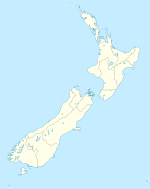
Manuka Bay Location North Canterbury East Coast, South Island, New Zealand Coordinates 42°53′32″S 173°18′31″E / 42.8923°S 173.3086°E River sources Hurunui River Countries  New Zealand
Settlements Cheviot References [1][2] Manuka Bay is located on the North Canterbury East Coast, northeast of the Hurunui River in the South Island of New Zealand. It is near Napenape and the town of Cheviot.[1][2]
The area is a popular destination for people who are travelling from coast to coast. It has a black sand beach and a camping ground. It has no stores or gas stations. [3]
External links
Sources
- ^ a b "Manuka Bay Lodge is a coastal property for sale with beachfront and ocean views". Cheviot.org.nz. http://www.cheviot.org.nz/location.html. Retrieved 2010-03-10.
- ^ a b "Manuka Bay new zealand - Google Maps". Maps.google.com. 1970-01-01. http://maps.google.com/maps?hl=en&q=Manuka%20Bay%20new%20zealand&aql=&um=1&ie=UTF-8&sa=N&tab=wl. Retrieved 2010-03-10.
- ^ "Manuka Bay Lodge is a coastal property for sale with beachfront and ocean views". Cheviot.org.nz. http://www.cheviot.org.nz/localinformation.html. Retrieved 2010-03-10.
Categories:- Bays of New Zealand
- Geography of the Canterbury Region
- Canterbury Region geography stubs
Wikimedia Foundation. 2010.

