- Manuel Tames
-
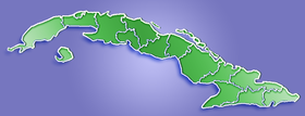
Manuel Tames — Municipality — Location of Manuel Tames in Cuba Coordinates: 20°10′49″N 75°03′5″W / 20.18028°N 75.05139°WCoordinates: 20°10′49″N 75°03′5″W / 20.18028°N 75.05139°W Country  Cuba
CubaProvince Guantánamo Area[1] – Total 526 km2 (203.1 sq mi) Elevation 175 m (574 ft) Population (2004)[2] – Total 14,200 – Density 27.0/km2 (69.9/sq mi) Time zone EST (UTC-5) Area code(s) +53-21 Manuel Tames is a municipality and city in the Guantánamo Province of Cuba. It is located 15 kilometres (9.3 mi) east of the provincial capital, Guantánamo.
Demographics
In 2004, the municipality of Manuel Tames had a population of 14,200.[2] With a total area of 526 km2 (203 sq mi),[1] it has a population density of 27.0 /km2 (70 /sq mi).
See also
References
- ^ a b Statoids. "Municipios of Cuba". http://www.statoids.com/ycu.html. Retrieved 2007-10-05.
- ^ a b Atenas.cu (2004). "2004 Population trends, by Province and Municipality". http://www.atenas.inf.cu/todo/Estadisticas/TABLA%20No_3balance.htm. Retrieved 2007-10-05. (Spanish)
Baracoa · Caimanera · El Salvador · Guantánamo · Imías · Maisí · Manuel Tames · Niceto Pérez · San Antonio del Sur · Yateras Categories:
- Populated places in Cuba
- Guantánamo Province
- Cuba geography stubs
Wikimedia Foundation. 2010.

