- Maisí
-
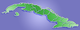
Maisí — Municipality — Location of Maisí in Cuba Coordinates: 20°14′35″N 74°09′22″W / 20.24306°N 74.15611°WCoordinates: 20°14′35″N 74°09′22″W / 20.24306°N 74.15611°W Country  Cuba
CubaProvince Guantánamo Area[1] – Total 525 km2 (202.7 sq mi) Elevation 25 m (82 ft) Population (2004)[2] – Total 28,276 – Density 53.9/km2 (139.6/sq mi) Time zone EST (UTC-5) Area code(s) +53-21 Maisí is a municipality and town in the Guantánamo Province of Cuba.
The easternmost point of Cuba, Punta Maisí (called "Baitiquiri"[3] by the Taino in pre-colonial times) is located in this municipality.
Demographics
In 2004, the municipality of Maisí had a population of 28,276.[2] With a total area of 525 km2 (203 sq mi),[1] it has a population density of 53.9 /km2 (140 /sq mi).
See also
References
- ^ a b Statoids. "Municipios of Cuba". http://www.statoids.com/ycu.html. Retrieved 2007-10-05.
- ^ a b Atenas.cu (2004). "2004 Population trends, by Province and Municipality" (in Spanish). Archived from the original on 2007-09-27. http://web.archive.org/web/20070927111826/http://www.atenas.inf.cu/todo/Estadisticas/TABLA+No_3balance.htm. Retrieved 2007-10-05.
- ^ Taino-Tribe.org. "Taino Dictionary" (in Spanish). http://www.taino-tribe.org/terms1.htm. Retrieved 2007-10-18.
Baracoa · Caimanera · El Salvador · Guantánamo · Imías · Maisí · Manuel Tames · Niceto Pérez · San Antonio del Sur · Yateras Categories:
- Populated places in Cuba
- Guantánamo Province
- Cuba geography stubs
Wikimedia Foundation. 2010.

