Manor Fields

Manor Fields
Manor Fields
Bletchley Rugby and Cricket Club House - geograph.org.uk - 209843.jpg
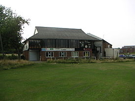
Ground information
Location Bletchley, Northamptonshire
Establishment 1973 (first recorded match)

Domestic team information
Northamptonshire (1976-1984 & 1987)
Buckinghamshire (1986 & 1988)

Manor Fields is a cricket ground in Bletchley, Northamptonshire. The first recorded match on the ground was in 1973, when Young England women played International XI women in the grounds only Women's One Day International.[1]

In 1975 the ground held its only Second XI Championship fixture when the Northamptonshire Second XI played the Lancashire Second XI.[2] In 1976, the ground held its first List-A match when Northamptonshire played Lancashire in the John Player League. Between 1976 and 1983, the ground held 7 List-A matches, the last of which saw Northamptonshire play Middlesex in the 1983 John Player Special League.[3]

Northamptonshire first played first-class cricket at the ground in 1980 when it played the touring West Indians. The ground held 2 further first-class matches, the first in 1984 which was a repeat of the 1980 fixture and the last of which saw Northamptonshire play the touring Pakistanis in 1987.[4]

In 1986, Buckinghamshire played their first Minor Counties Championship fixture on the ground against the Somerset Second XI. They returned in 1988 to play their last Minor Counties Championship match at the ground to date, which came against Wales Minor Counties.[5]

In local domestic cricket, the ground is the home venue of Bletchley Town Cricket Club.[6]

References

External links

Coordinates: 51°59′39″N 0°42′41″W / 51.99422°N 0.71137°W / 51.99422; -0.71137


Wikimedia Foundation. 2010.

Игры ⚽ Нужно сделать НИР?

Look at other dictionaries:

  • Manor, Texas —   City   Sign indicating Manor …   Wikipedia

  • Manor Creek, Kentucky —   City   …   Wikipedia

  • Manor House, London — This article is about the district in North London. For the building in Soho, see Manor House, 21 Soho Square. Coordinates: 51°34′19″N 0°05′48″W / 51.57182°N 0.09671°W …   Wikipedia

  • Manor — For other uses, see Manor (disambiguation). Conjectural map of a mediaeval manor. The method of strip farming was in use under the open field system. The brown areas are part of the demesne, the shaded areas part of the glebe. The manor house,… …   Wikipedia

  • Manor College — Not to be confused with Manor College of Technology. Manor College Motto America s Premier Two Year Catholic College Established 1947 Type Priv …   Wikipedia

  • Manor Park Country Park — Not to be confused with Manor Farm Country Park. . Coordinates: 51°17′12″N 0°24′07″E / 51.2868°N 0.4020°E / 51.2868; 0.4020 …   Wikipedia

  • Manor of Rivington — The Manor of Rivington was a medieval manor estate in Rivington, Lancashire, England. Before 1212 the Pilkington family owned six oxgangs of land. Over time it became separated in moieties and by the 16th century the Pilkingtons of Rivington Hall …   Wikipedia

  • Manor of Northstead — Crown Steward and Bailiff of the Manor of Northstead Arms of Her Majesty s Government …   Wikipedia

  • St George's Fields — was an area of Southwark in South London.Originally the area was an undifferentiated part of the south side of the Thames, which was low lying marshland unsuitable for even agricultural purposes. As such it was part of the extensive holdings of… …   Wikipedia

  • Meerkat Manor — Genre Nature Documentary Drama Created by Caroline Hawkins Narr …   Wikipedia

Share the article and excerpts

Direct link
Do a right-click on the link above
and select “Copy Link”