- Manito Mitchell Airport
-
Manito Mitchell Airport IATA: none – ICAO: none – FAA LID: C45 Summary Airport type Public Owner Palmer Flying Service Serves Manito, Illinois Elevation AMSL 501 ft / 153 m Coordinates 40°29′22″N 89°46′41″W / 40.48944°N 89.77806°WCoordinates: 40°29′22″N 89°46′41″W / 40.48944°N 89.77806°W Maps Location of Tazewell County in Illinois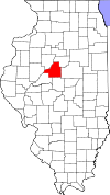 Location of airport in Tazewell County
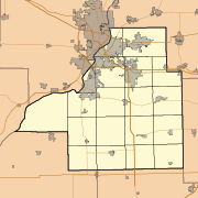
 C45
C45Runways Direction Length Surface ft m 4/22 2,784 849 Asphalt 18/36 2,188 667 Asphalt/Turf Statistics (2009) Aircraft operations 6,000 Based aircraft 12 Source: Federal Aviation Administration[1] Manito Mitchell Airport (FAA LID: C45) is a privately-owned public-use airport in Tazewell County, Illinois, United States. It is located three nautical miles (3.5 mi, 5.6 km) north of the central business district of Manito, a village in Mason County.[1]
Facilities and aircraft
Manito Mitchell Airport covers an area of 80 acres (32 ha) at an elevation of 501 feet (153 m) above mean sea level. It has two runways: 4/22 is 2,784 by 40 feet (849 x 12 m) with an asphalt pavement; 18/36 is 2,188 by 40 feet (667 x 12 m) with an asphalt and turf surface.[1]
For the 12-month period ending December 31, 2009, the airport had 6,000 aircraft operations, an average of 16 per day: 97% general aviation and 3% military. At that time there were 12 single-engine aircraft based at this airport.[1]
References
- ^ a b c d FAA Airport Master Record for C45 (Form 5010 PDF). Federal Aviation Administration. Effective 30 June 2011.
External links
- Aerial photo as of 14 April 1998 from USGS The National Map
- Resources for this airport:
- AirNav airport information for C45
- FlightAware airport information and live flight tracker
- SkyVector aeronautical chart for C45
Categories:- Airports in Illinois
- Tazewell County, Illinois


Wikimedia Foundation. 2010.