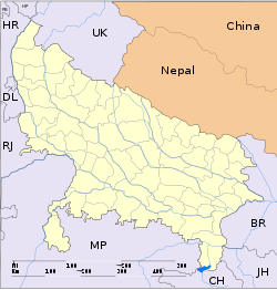
- Mandhana
-
Mandhana — suburb — Coordinates 26°21′N 80°05′E / 26.35°N 80.09°ECoordinates: 26°21′N 80°05′E / 26.35°N 80.09°E Country India State Uttar Pradesh District(s) Kanpur Nearest city Bithoor, Chobepur, Kalyanpur Parliamentary constituency Mandhana Assembly constituency Mandhana(w), Mandhana(e), Mandhana - Rural Population 20,000 Literacy 60% Time zone IST (UTC+05:30) Codes-
• Vehicle • UP-78
Mandhana is a town in Uttar Pradesh, India, situated about 20 km from Kanpur on the Grand Trunk Road to Delhi.The population was 20000 as of the 2001 census.It has 60% of literacy and is 5 km from Chobepur,a Kanpur suburb.It also Comes under Kanpur Metropolitan Region
Travel
Mandhana has a bus station and UPSRTC Busses of Kanpur have routes from Mandhana to different different localities. Mandhana has a railway station on the Kanpur-Farrukhabad line. Kalyanpur Airstrip is nearest airport.
Tourist attractions
The pilgrimage spot of Bithoor is 8 km from the town.
Categories:- Kanpur
- Cities and towns in Kanpur Dehat district
- Kanpur division geography stubs
-
Wikimedia Foundation. 2010.


