Manciano, Umbria

Manciano, Umbria
Manciano
—  Frazione  —
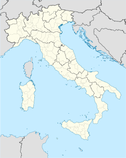
Manciano is located in Italy
Manciano
Coordinates: 42°54′N 12°46′E / 42.9°N 12.767°E / 42.9; 12.767Coordinates: 42°54′N 12°46′E / 42.9°N 12.767°E / 42.9; 12.767
Country  Italy
Region Umbria
Province Perugia
Comune Trevi
Elevation[1] 509 m (1,670 ft)
Population (2001)[1]
 - Total 100
  (estimate)
Time zone CET (UTC+1)
 - Summer (DST) CEST (UTC+2)
Postcode 06039
Area code(s) 0742

Manciano is a village in the Italian province of Perugia in east central Umbria on a flank of Mt. Matigge, at altitude 509 m above sea-level. It is a frazione of the comune of Trevi, which is 3 km  SSW. Its population is approximately 100 inhabitants.

The main point of interest of the village is the church of S. Martino and, not far away, the beautiful ruins of the Romanesque abbey church of Santo Stefano in Manciano.

The frazione extends several kilometers further to the NE into the Apennine range and the hamlet of Ponze at 904 m altitude, with one more medieval church and a good view of central Umbria.

References

  1. ^ a b "Census". Istituto Nazionale di Statistica. http://dawinci.istat.it/daWinci/jsp/MD/dawinciMD.jsp. 

External links


Wikimedia Foundation. 2010.

Игры ⚽ Нужно сделать НИР?

Look at other dictionaries:

  • Manciano (disambiguation) — Manciano may refer to several places in Italy: Manciano, a comune in the Province of Grosseto, Tuscany Manciano, Umbria, a frazione of Trevi in the Province of Perugia, Umbria Manciano, a locality of Morlupo in the Province of Rome, Lazio… …   Wikipedia

  • Manciano (PG) — Manciano is a village in the Italian province of Perugia in east central Umbria on a flank of Mt. Matigge, at altitude 509 m above sea level. It is a frazione of the comune of Trevi, which is 3 km SSW. Its population is probably less than 100.… …   Wikipedia

  • Santo Stefano in Manciano — is a medieval abbey, long abandoned, at Manciano ( frazione of Trevi)) in Umbria, Italy. Now only the beautiful ruined church, dating at the latest to the first half of the 13th century, remains.External links*… …   Wikipedia

  • Trevi — Infobox CityIT img coa = trevi Stemma.gif official name = Comune di Trevi name = Trevi region = Umbria province = Perugia (PG) elevation m = 412 area total km2 = 71.2 population as of = Dec. 2004 population total = 8007 population density km2 =… …   Wikipedia

  • Anexo:Localidades de Italia — Lista de las comune de Italia: Comune Provincia Región Abano Terme Padua Véneto Abbadia Cerreto Lodi Lombardía Abbadia Lariana Lecco Lombardía …   Wikipedia Español

  • Postleitzahl (Italien) — Postleitzahlen Gebiete in Italien nach den ersten beiden Stellen Die italienischen Postleitzahlen wurde am 1. Juli 1967 eingeführt. Sie ist fünfstellig und ist ohne Weglassen von Nullen an ihrem Anfang und Ende vollständig anzugeben. Die… …   Deutsch Wikipedia

  • Trevi — Trevi …   Wikipedia Español

  • List of Romanesque architecture — urviving Romanesque buildingsListed below are examples of surviving buildings in Romanesque style in Europe.FranceRomanesque architecture expands in France through monasteries. Burgundy was the center of monastic life in France one of the most… …   Wikipedia

  • Trevi — Pour les articles homonymes, voir Trevi (homonymie). Trevi Panorama Administration …   Wikipédia en Français

  • Trevi (Umbrien) — Trevi …   Deutsch Wikipedia

Share the article and excerpts

Direct link
Do a right-click on the link above
and select “Copy Link”