- Malton, California
-
Coordinates: 39°47′44″N 122°10′47″W / 39.79556°N 122.17972°W
Malton — Former settlement — Location in California
 Malton
Coordinates: 39°47′44″N 122°10′47″W / 39.79556°N 122.17972°W Country United States State California County Glenn County Elevation[1] 253 ft (77 m) Malton is a former settlement in Glenn County, California.[1] It was located on the Southern Pacific Railroad 3.5 miles (5.6 km) north-northeast of Orland,[2] at an elevation of 253 feet (77 m).[1] Malton still appeared on maps as of 1917.[1]
References
Municipalities and communities of Glenn County, California Cities 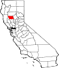
CDPs Unincorporated
communitiesAfton | Alder Springs | Bayliss | Bluegum | Butte City | Capay | Chrome | Codora | Copper City | Cory | Dogtown | Fiddlers Green | Fruto | Glenn | Grapit | Greenwood | Jacinto | Jenks Place | Keller Place | Kirkwood | Logandale | Lone Star | Meyers Place | Mills Orchard | Newville | Norman | Ordbend | Rotavele | Wilson Place | Wyo
Indian
reservationsGrindstone Indian Rancheria of Wintun-Wailaki Indians
Ghost towns Belvedere | Floyd | Kanawha | Kurand | Losa | Lyman | Malton | Millsaps | Millsholm | Monroeville | Olimpo | Reynolds Place | Winslow
Categories:- Former settlements in Glenn County, California
- Former populated places in California
- Sacramento Valley geography stubs


Wikimedia Foundation. 2010.