- Malanpur
-
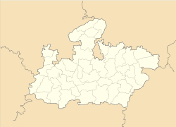
Malanpur — town — Coordinates 26°13′N 78°10′E / 26.21°N 78.17°ECoordinates: 26°13′N 78°10′E / 26.21°N 78.17°E Country India State Madhya Pradesh District(s) Bhind Population 5,296 (2001[update]) Time zone IST (UTC+05:30) Codes-
• Pincode • 477335 • Vehicle • MP 30
Website www.iidcgwl.com/files/c-1-1.htm?page=malanpur Malanpur is an Industrial Area in Bhind District of Madhya Pradesh, being managed by the Industrial Infrastructure Development Corporation (Gwalior) M.P. Ltd. (Formerly known as AKVN Gwalior).
Contents
Geography
Malanpur is Located at 26°13′N 78°10′E / 26.21°N 78.17°E.[1] Malanpur is an industrial town spread over 625 hectares in northern Madhya Pradesh state located in north-central India. it is about 10 km from Gwalior, therefor is considered as a suburb of Gwalior also.
Industries
Malanpur Industrial Growth Center is being promoted and managed by AKVN Gwalior.[2] The industrial area have attracted many manufacturing units, including India's most reputed corporates. some of the companies which have their production facilities in Malanpur are:[3]
- Cadbury India
- Jamna Auto
- Surya Industries
- Godrej
- Hotline
- Crompton Greaves
- Kodak
- Ranbaxy
- SRF Ltd.
Connectivity
Malanpur is well connected by roads as it is Located on NH 92 connecting Gwalior with Bhind. The nearest railway station is Rithora, & nearest major railway station is Gwalior.
References
Categories:- Cities and towns in Bhind district
-
Wikimedia Foundation. 2010.


