- Magueyes Urbano
-
Barrio Magueyes Urbano Location of barrio Magueyes Urbano within the municipality of Ponce shown in red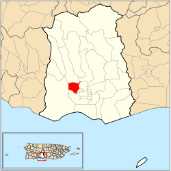
Country  United States
Territory  Puerto Rico
Municipality  Ponce
PonceArea - Total 1.24 sq mi (3.2 km2) - Land 1.24 sq mi (3.2 km2) - Water 0.00 sq mi (0 km2) Population (2000) - Total 1,332 - Density 1,074/sq mi (414.7/km2) Source: 2000 Census Magueyes Urbano is one of the 31 barrios in the municipality of Ponce, Puerto Rico. Along with Canas Urbano, Machuelo Abajo, Portugués Urbano, and San Antón, Magueyes Urbano is one of the municipality's five originally rural barrios that are now also part of the urban zone of the city of Ponce.
Contents
Location
Magueyes Urbano is an urban barrio located in the southern section of the municipality, within the Ponce city limits, and northwest of the traditional center of the city, Plaza Las Delicias.
Boundaries
It is bounded on the North by J. J. Cartagena Street (Las Delicias community), Ruth Fernandez Boulevard, and Camino de Ponce (Golf Club) Road, on the South by PR-123, Ausencia Street, and La Gloria Street, on the West by the hills west of PR-123, and on the East by Novedades Street, the hills east of Ponce Cement and the future western branch of PR-9.[1][2]
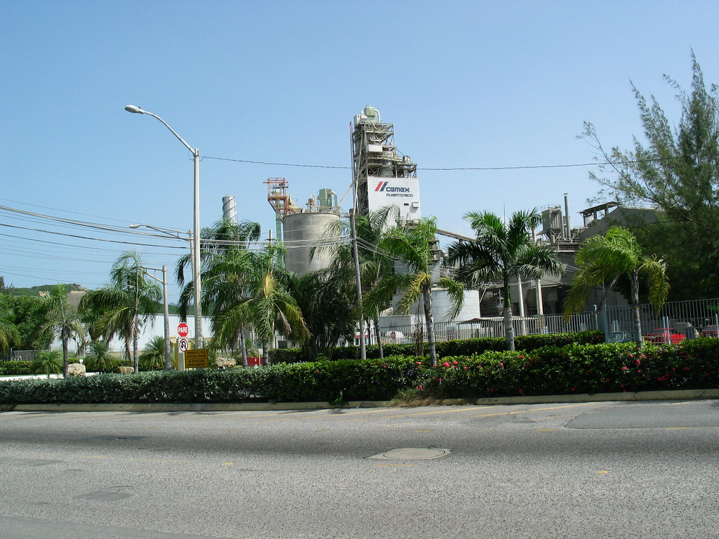
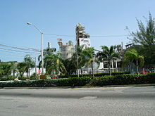 The old Ponce Cement plant in Barrio Magueyes Urbano (the plant is now owned by CEMEX)
In terms of barrio-to-barrio boundaries, Magueyes Urbano is bounded in the North by Magueyes, in the South by Canas Urbano, in the West by Canas, and in the East by Portugués Urbano.Autonomous Municipality of Ponce. Office of Territorial Planning. (Municipio Autonomo de Ponce. Oficina de Ordenacion Territorial.) [3]
The community of Las Delicias is found here.Autonomous Municipality of Ponce. Office of Territorial Planning. (Municipio Autonomo de Ponce. Oficina de Ordenacion Territorial.)
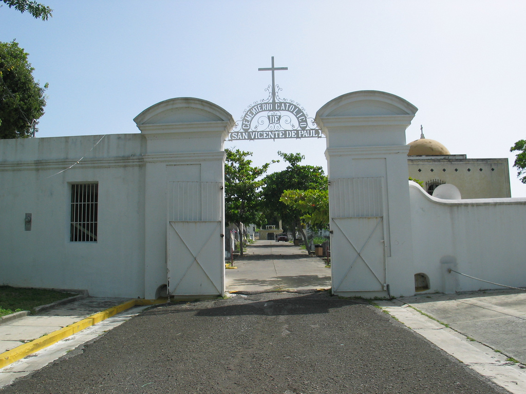
 The Cementerio Catolico San Vicente de Paul, a historic landmark, is located in Barrio Magueyes Urbano.
Features and demographics
Magueyes Urbano has 1.2 square miles (3.1 km2) of land area and no water area. In 2000, the population of Magueyes Urbano was 1,332 persons, and it had a density of 1,070 persons per square mile.[4][5]
Major roads in Magueyes Urbano are PR-123 and PR-9.
Notable landmarks
Barrio Magueyes Urbano is home to Ponce Cement, Inc. and the NRHP-listed Cementerio Catolico San Vicente de Paul.
Coordinates: 18°01′34″N 66°38′17″W / 18.0262226°N 66.6379260°W[6]
References
- ^ Government of the Commonwealth of Puerto Rico. General Purpose Population Data, Census 2000. Unidad de Sistemas de Información Geográfica, Área de Tecnología de Información Gubernamental, Oficina de Gerencia y Presupuesto. Gobierno de Puerto Rico. Retrieved February 24, 2010.
- ^ U.S. Geological Survey. Topographic Map od Ponce. Map Styles: Map and Shaded. Trails.com. From: USGS. Topo Map. Projection: NAD83/WGS84. Retrieved February 24, 2010.
- ^ Arecibo Web. Ponce, Puerto Rico: Barrios. Retrieved February 24, 2010.
- ^ U.S. Census Bureau. Census 2000. Ponce and Its Barrios. (Ponce Municipio, Puerto Rico -- County Subdivision and Place. GCT-PH1. Population, Housing Units, Area, and Density: 2000. Data Set: Census 2000 Summary File 1 (SF 1) 100-Percent Data) Retrieved February 24, 2010.
- ^ City Melt Retrieved, February 24, 2010.
- ^ U.S. Geological Survey Geographic Names Information System: Magueyes Urbano Barrio
Categories:- Barrios of Ponce

Wikimedia Foundation. 2010.