- Gorenje pri Zrečah
-
Gorenje pri Zrečah Location in Slovenia Coordinates: 46°24′4.14″N 15°23′23.17″E / 46.40115°N 15.3897694°ECoordinates: 46°24′4.14″N 15°23′23.17″E / 46.40115°N 15.3897694°E Country  Slovenia
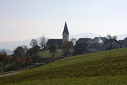
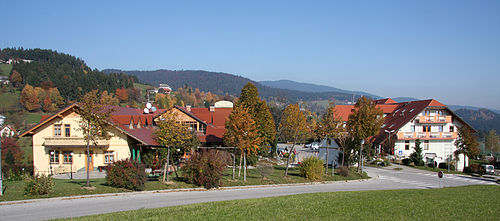
Traditional region Lower Styria Statistical region Savinja Municipality Zreče Area – Total 1.56 km2 (0.6 sq mi) Elevation 761.8 m (2,499 ft) Population (2002) – Total 114 [1] Gorenje pri Zrečah is a settlement in the Zreče municipality in northeastern Slovenia. The area was traditionally part of the Lower Styria region. It is now included with the rest of the municipality into the Savinja statistical region.[2]
The local church is dedicated to Saint Cunigunde and belongs to the Zreče parish. It dates to the late 14th century with extensive rebuilding in the 17th century.[3]
References
External links
Zreče Settlements Administrative centre: Zreče
Bezovje nad Zrečami, Boharina, Bukovlje, Čretvež, Črešnova, Drobovlje, Gorenje pri Zrečah, Gornja vas, Gračič, Koroška vas na Pohorju, Križevec, Lipa, Loška Gora pri Zrečah, Mala Gora, Osredek pri Zrečah, Padeški Vrh, Planina na Pohorju, Polajna, Radana vas, Resnik, Rogla, Skomarje, Spodnje Stranice, Stranice, Zabork, ZlakovaLandmarks Categories:- Populated places in the Municipality of Zreče
- Savinjska statistical region geography stubs
Wikimedia Foundation. 2010.


