- Drahoňův Újezd
-
Drahoňův Újezd — Municipality — Location in Rokycany District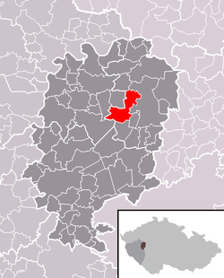 Location in the Czech Republic
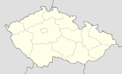
 Drahoňův Újezd
Coordinates: 49°51′46″N 13°43′2″E / 49.86278°N 13.71722°ECoordinates: 49°51′46″N 13°43′2″E / 49.86278°N 13.71722°E Country  Czech Republic
Region Plzeň District Rokycany Area – Total 13.99 km2 (5.4 sq mi) Elevation 410 m (1,345 ft) Population (2006) – Total 130 – Density 9.3/km2 (24.1/sq mi) Postal code 338 08 Website http://www.drahonuv-ujezd.cz/ Drahoňův Újezd is a village and municipality (obec) in Rokycany District in the Plzeň Region of the Czech Republic.
The municipality covers an area of 13.99 square kilometres (5.40 sq mi), and has a population of 130 (as at 28 August 2006).
Drahoňův Újezd lies approximately 16 kilometres (10 mi) north-east of Rokycany, 28 km (17 mi) north-east of Plzeň, and 57 km (35 mi) south-west of Prague.
References
Towns, market town and villages of Rokycany District Bezděkov • Břasy • Březina • Bujesily • Bušovice • Cekov • Cheznovice • Chlum • Chomle • Čilá • Dobřív • Drahoňův Újezd • Ejpovice • Hlohovice • Holoubkov • Hrádek • Hradiště • Hůrky • Kakejcov • Kamenec • Kamenný Újezd • Kařez • Kařízek • Klabava • Kladruby • Kornatice • Lhota pod Radčem • Lhotka u Radnic • Liblín • Líšná • Litohlavy • Medový Újezd • Mešno • Mirošov • Mlečice • Mýto • Němčovice • Nevid • Osek • Ostrovec-Lhotka • Plískov • Podmokly • Příkosice • Přívětice • Radnice • Raková • Rokycany • Sebečice • Sirá • Skomelno • Skořice • Smědčice • Štítov • Strašice • Svojkovice • Těně • Terešov • Těškov • Trokavec • Týček • Újezd u Svatého Kříže • Vejvanov • Veselá • Vísky • Volduchy • Všenice • Zbiroh • Zvíkovec
This Plzeň Region location article is a stub. You can help Wikipedia by expanding it.

