- Dolní Studénky
-
Dolní Studénky — Municipality — 
Flag
Coat of arms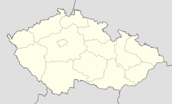
 Dolní Studénky
Coordinates: 49°56′3″N 16°58′31″E / 49.93417°N 16.97528°ECoordinates: 49°56′3″N 16°58′31″E / 49.93417°N 16.97528°E Country  Czech Republic
Region Olomouc District Šumperk Area – Total 8.51 km2 (3.3 sq mi) Elevation 300 m (984 ft) Population (2006) – Total 1,295 – Density 152.2/km2 (394.1/sq mi) Postal code 788 20 Website http://www.obecdolnistudenky.cz/ Dolní Studénky (German: Schönbrunn) is a village and municipality (obec) in Šumperk District in the Olomouc Region of the Czech Republic.
The municipality covers an area of 8.51 square kilometres (3.29 sq mi), and has a population of 1,295 (as at 28 August 2006).
Dolní Studénky lies approximately 4 kilometres (2 mi) south of Šumperk, 43 km (27 mi) north-west of Olomouc, and 184 km (114 mi) east of Prague.
References
Towns and villages of Šumperk District Bludov · Bohdíkov · Bohuslavice · Bohutín · Branná · Bratrušov · Brníčko · Bušín · Dlouhomilov · Dolní Studénky · Drozdov · Dubicko · Hanušovice · Horní Studénky · Hoštejn · Hraběšice · Hrabišín · Hrabová · Hynčina · Chromeč · Jakubovice · Janoušov · Jedlí · Jestřebí · Jindřichov · Kamenná · Klopina · Kolšov · Kopřivná · Kosov · Krchleby · Lesnice · Leština · Libina · Líšnice · Loštice · Loučná nad Desnou · Lukavice · Malá Morava · Maletín · Mírov · Mohelnice · Moravičany · Nemile · Nový Malín · Olšany · Oskava · Palonín · Pavlov · Petrov nad Desnou · Písařov · Police · Postřelmov · Postřelmůvek · Rájec · Rapotín · Rejchartice · Rohle · Rovensko · Ruda nad Moravou · Sobotín · Staré Město · Stavenice · Sudkov · Svébohov · Šléglov · Štíty · Šumperk · Třeština · Úsov · Velké Losiny · Vernířovice · Vikantice · Vikýřovice · Vyšehoří · Zábřeh · Zborov · Zvole
This Olomouc Region location article is a stub. You can help Wikipedia by expanding it.