- Dollar Lake (Wallowa County, Oregon)
-
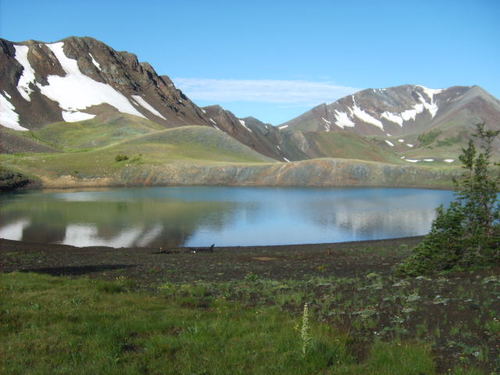
Dollar Lake 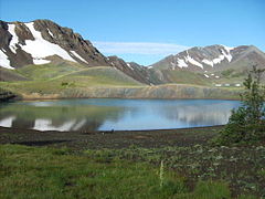
Location Eagle Cap Wilderness, Wallowa County, Oregon, USA Coordinates 45°11′24″N 117°11′16″W / 45.1899°N 117.1877°WCoordinates: 45°11′24″N 117°11′16″W / 45.1899°N 117.1877°W Lake type Tarn Basin countries United States Max. length 199 yd (182 m) Max. width 163 yd (149 m) Average depth 49 ft (15 m) Max. depth 272 ft (83 m) Surface elevation 8,300 ft (2,500 m) Dollar Lake is a small tarn located on Aneroid Mountain in the Eagle Cap Wilderness of Northeastern Oregon, United States. It is situated between Aneroid Lake and Bonny Lakes and rests one mile SW from Aneroid Peak.[1][2] It likely received its name because of its size and its almost perfectly round shape, much like that of a silver dollar. It is the fifth-highest lake in the Eagle Cap Wilderness.[3]
Trail
Dollar Lake can be accessed by Trail 1802. If the climber is traveling from Tenderfoot Trailhead or Tenderfoot Wagon Road Trail, then the climber will pass Bonny Lakes about 1 3/4 miles before reaching Dollar Pass. Once the trail reaches Dollar Pass, elevation 8,420, the climber must leave the trail and head southwest for about one quarter mile.[1] A navigation device such as a compass or a GPS is recommended.
References
Categories:- Lakes of Oregon
- Landforms of Wallowa County, Oregon
- Oregon geography stubs
Wikimedia Foundation. 2010.