- Dobytown, Nebraska
-
Dobytown
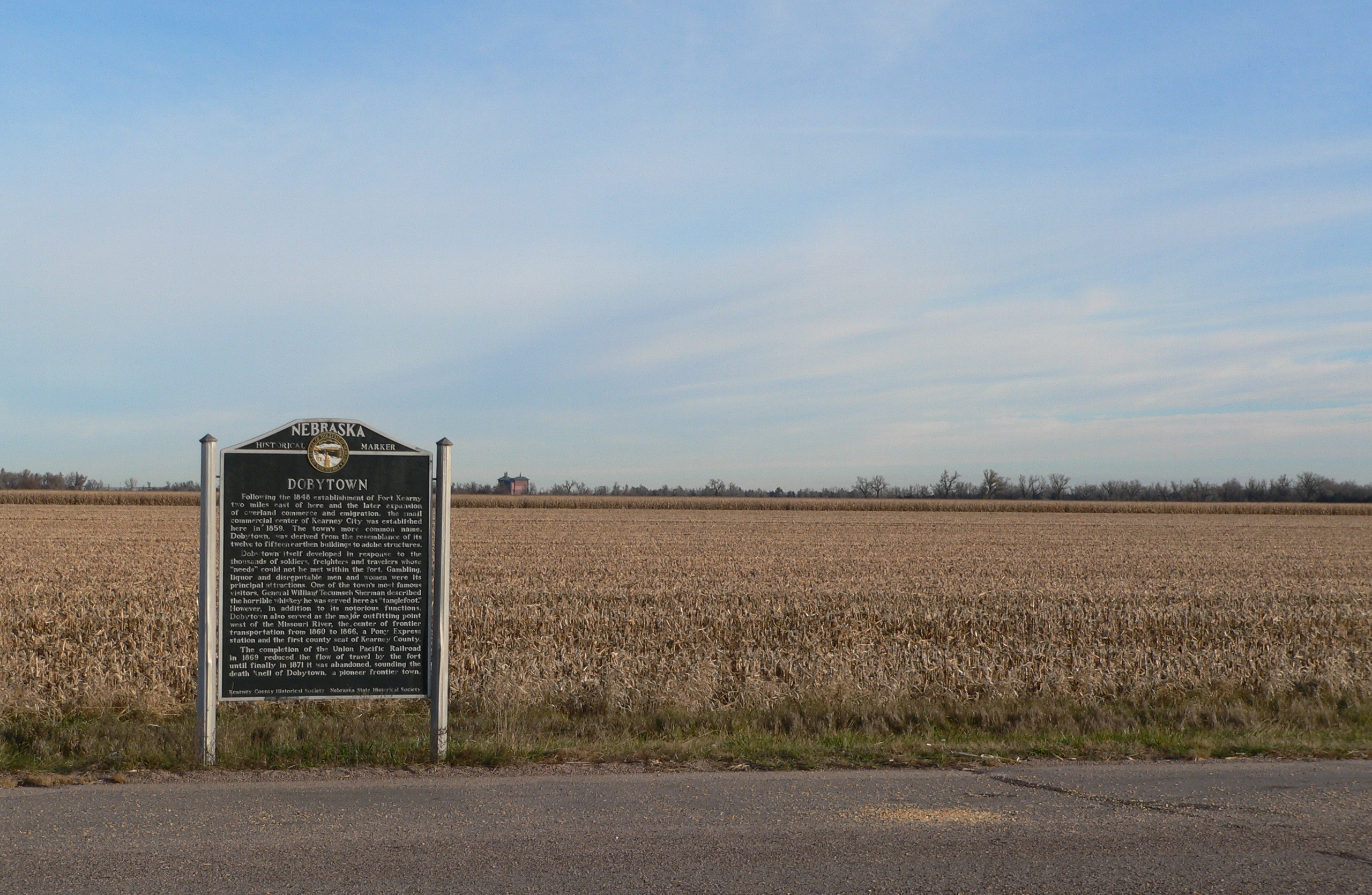
 Modern view of the Dobytown site

Location: Kearney County, Nebraska Nearest city: Kearney, Nebraska Coordinates: 40°38′30″N 99°2′51″W / 40.64167°N 99.0475°WCoordinates: 40°38′30″N 99°2′51″W / 40.64167°N 99.0475°W Built: 1859 Governing body: Private NRHP Reference#: 74001125[1] Added to NRHP: December 16, 1974 Dobytown is a ghost town in Kearney County, Nebraska, United States,[2] three miles west of Fort Kearny. Officially named Kearney City, the community was established in 1859. Its common name of Dobytown was derived from the resemblance of its twelve to fifteen earthen buildings to adobe structures.[citation needed] Although the community no longer exists,[2] the site was added to the National Register of Historic Places in 1974.[1] The site is located at an altitude of 2,129 feet (649 m).[2]
Like many new frontier communities, Dobytown evolved to meet the needs of the thousands of soldiers, traders, teamsters and pioneers traveling west. Gambling, liquor and disreputable men and women were its main attractions. Dobytown also served as the major outfitting point west of the Missouri River, the center of frontier transportation from 1860 to 1866. A Pony Express station was located in Dobytown and it was the first county seat of Kearney County.
One of Dobytown's most famous visitors, General William Tecumseh Sherman described the horrible whiskey he was served there as tanglefoot.
The completion of the Union Pacific Railroad in 1869 reduced the travel along the trail and by the fort. The U.S. Army issued an order for abandonment of Fort Kearny on 22 May 1871. This caused Dobytown to be abandoned.
References
- ^ a b "National Register Information System". National Register of Historic Places. National Park Service. 2008-04-15. http://nrhp.focus.nps.gov/natreg/docs/All_Data.html.
- ^ a b c U.S. Geological Survey Geographic Names Information System: Dobytown, Nebraska
Municipalities and communities of Kearney County, Nebraska City 
Villages Townships Ghost town Dobytown
Categories:- Ghost towns in Nebraska
- Geography of Kearney County, Nebraska
- National Register of Historic Places in Nebraska
- Pony Express stations
- Nebraska geography stubs
- United States ghost town stubs

Wikimedia Foundation. 2010.