- Horní Loděnice
-
Horní Loděnice — Municipality — 
Flag
Coat of arms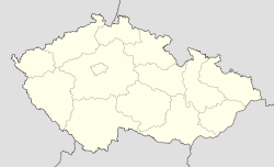
 Horní Loděnice
Coordinates: 49°46′12″N 17°21′59″E / 49.77°N 17.36639°ECoordinates: 49°46′12″N 17°21′59″E / 49.77°N 17.36639°E Country  Czech Republic
Region Olomouc District Olomouc Area – Total 18.18 km2 (7 sq mi) Elevation 543 m (1,781 ft) Population (2006) – Total 352 – Density 19.4/km2 (50.1/sq mi) Postal code 783 05 Website http://www.hornilodenice.cz Horní Loděnice is a village and municipality (obec) in Olomouc District in the Olomouc Region of the Czech Republic.
The municipality covers an area of 18.18 square kilometres (7.02 sq mi), and has a population of 352 (as at 3 July 2006).
Horní Loděnice lies approximately 22 kilometres (14 mi) north-east of Olomouc and 214 km (133 mi) east of Prague.
References
Towns, market towns and villages of Olomouc District Babice · Bělkovice-Lašťany · Bílá Lhota · Bílsko · Blatec · Bohuňovice · Bouzov · Bukovany · Bystročice · Bystrovany · Červenka · Charváty · Cholina · Daskabát · Dlouhá Loučka · Dolany · Doloplazy · Domašov nad Bystřicí · Domašov u Šternberka · Drahanovice · Dub nad Moravou · Dubčany · Grygov · Haňovice · Hlásnice · Hlubočky · Hlušovice · Hněvotín · Hnojice · Horka nad Moravou · Horní Loděnice · Hraničné Petrovice · Huzová · Jívová · Komárov · Kožušany-Tážaly · Krčmaň · Křelov-Břuchotín · Liboš · Lipina · Lipinka · Litovel · Loučany · Loučka · Luběnice · Luká · Lutín · Lužice · Majetín · Medlov · Měrotín · Mladeč · Mladějovice · Moravský Beroun · Mrsklesy · Mutkov · Náklo · Náměšť na Hané · Norberčany · Nová Hradečná · Olbramice · Olomouc · Paseka · Pňovice · Přáslavice · Příkazy · Řídeč · Samotišky · Senice na Hané · Senička · Skrbeň · Slatinice · Slavětín · Štarnov · Štěpánov · Šternberk · Strukov · Střeň · Suchonice · Šumvald · Svésedlice · Těšetice · Tovéř · Troubelice · Tršice · Újezd · Uničov · Ústín · Velká Bystřice · Velký Týnec · Velký Újezd · Věrovany · Vilémov · Želechovice · Žerotín
This Olomouc Region location article is a stub. You can help Wikipedia by expanding it.

