- Deer Creek Marsh Wildlife Management Area
-
Deer Creek Marsh Wildlife Management Area IUCN Category IV (Habitat/Species Management Area)
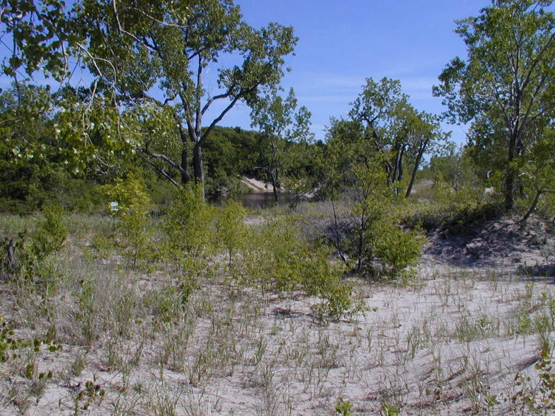
Sandy dune and wetland in June, Deer Creek Marsh Wildlife Management Area. The plants growing on the sand include American beachgrass and Eastern cottonwood trees.US state of New York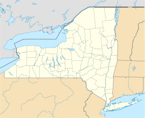
 Deer Creek Marsh WMA
Location Oswego County, New York Nearest city Oswego, New York Coordinates 43°36′04″N 76°11′53″W / 43.601°N 76.198°WCoordinates: 43°36′04″N 76°11′53″W / 43.601°N 76.198°W Area 1,195 acres (484 ha) Established 1979 Visitors 6600[1] (in 2009) Governing body N.Y. DEC Deer Creek Marsh Wildlife Management Area is an 1,195-acre (484 ha) New York State Wildlife Management Area (WMA) with a 4,500-foot (1,400 m) sandy beach on the eastern shore of Lake Ontario; it is in the Town of Richland in Oswego County, New York. Deer Creek Marsh lies at the southern limit of a 17-mile long region of sandy barrier beaches that protect coastal lagoons and marshes; the region is unusual geologically and is important as habitat for many species.[2][3] Deer Creek Marsh WMA is part of the Eastern Lake Ontario Marshes Bird Conservation Area, along with Black Pond and Lakeview WMAs and the Sandy Pond Beach Unique Area.[4] Some of the hiking and boating opportunities in the WMA are described in a brochure and a website created through the New York Sea Grant.[5][6]
Until 1979, Deer Creek Marsh was divided into a number of privately held properties. The sand that underlies the region was being mined for construction and industrial purposes, and led to concern about the long-term conservation of the area.[7] Efforts by New York State to make conventional purchases of these properties for a WMA were unsuccessful, and in the end the land was obtained through a controversial use of eminent domain.[8]
Within the year, a project to restore the dunes commenced. Debris and unused buildings were removed. The project was partly a response to massive erosion in the region following April 1979 storms. A commission studying this erosion concluded that it was exacerbated by the degraded state of the native beachgrass and other plants along the dunes;[9] beachgrass in particular builds and stabilizes coastal sand dunes. Damaged stands of beachgrass were replanted following some experiments with differing varieties and cultivation methods. These experiments were apparently the foundation for the extensive beachgrass restoration that was subsequently undertaken along the entire length of the eastern Lake Ontario coastal dunes.
Deer Creek Marsh WMA has also been designated a New York Natural Heritage Area.[10]
References
- ^ Kuehn, Diane; Habig, Rachel (January 2010). "Monitoring Recreational Use in the Eastern Lake Ontario Dune and Wetland Area". http://www.seagrant.sunysb.edu/glhabitat/PDFS/DuneMonitoringReport2010.pdf. See Table 4, p. 17.
- ^ Kautz, Maria (2008-01-18). "New Walkover at Deer Creek Marsh Wildlife Management Area Allows Visitors Access to Highly Sensitive Dunes". New York State Department of Environmental Conservation. http://www.dec.ny.gov/press/41406.html. Retrieved 2008-10-15.
- ^ "Deer Creek Marsh Wildlife Management Area Map". New York State Department of Environmental Conservation. http://www.dec.ny.gov/outdoor/27404.html. Retrieved 2008-10-15.
- ^ "Eastern Lake Ontario Marshes Bird Conservation Area". New York State Department of Environmental Conservation. http://www.dec.ny.gov/animals/27256.html. Retrieved 2008-10-18.
- ^ "Deer Creek". Archived from the original on 2007-10-28. http://web.archive.org/web/20071028045727/www.nysgextension.org/glhabitat/dunefun/deercreek.htm.
- ^ Earnest, Gillian; Kuehn, Diane; Thompson, Molly; Penney, Mary (2007). "Sand, Wind, & Water: A recreational guide to Eastern Lake Ontario's dunes and wetlands". New York Sea Grant. Archived from the original on 2010-07-27. http://www.webcitation.org/5rYABMGqI. Retrieved 2010-01-28.
- ^ Trautwein, Breck; Dragonetti, John. "Mining as a Threat to New York's Deer Creek Marsh". Archived from the original on 2010-01-26. http://www.webcitation.org/5n5TlWAnT. This report is undated; it presumably dates from the mid-1970s.
- ^ Padavano, Dan (1979-03-20). "State to Buy Ontario Beach: Eminent Domain Used on Deer Creek Marsh". The Syracuse Herald American: p. Metropolitan 17.
- ^ "Saving of Dunes is Project Aim". The Syracuse Post-Standard: p. C-1 (N). 1980-03-03.
- ^ "Natural Heritage Area Designation for Eastern Lake Ontario Barrier Beach and Wetland Complex". New York State Department of Environmental Conservation. http://www.dec.ny.gov/animals/38944.html. Retrieved 2010-01-24.
Categories:- IUCN Category IV
- New York State Wildlife Management Areas
- New York State Natural Heritage Areas
- Protected areas of Oswego County, New York

Wikimedia Foundation. 2010.