- Dawinkopf
-
Dawinkopf 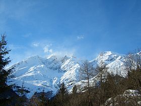
Elevation 2,970 m (9,744 ft) Location Tyrol, Austria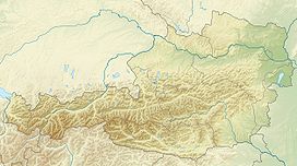
 Dawinkopf
Range Lechtal Alps Coordinates 47°10′0″N 10°28′0″E / 47.166667°N 10.466667°ECoordinates: 47°10′0″N 10°28′0″E / 47.166667°N 10.466667°E Dawinkopf is a mountain in Tyrol, Austria. At an elevation of 2,970 metres (9,740 ft), it is the second-highest mountain of the Lechtal Alps and the third highest in the Northern Limestone Alps.
Categories:- Mountains of Tyrol
- Lechtal Alps
- Tyrol geography stubs


Wikimedia Foundation. 2010.