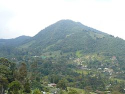
- Dapa, Valle del Cauca
-
This article is about the village in Colombia. For the Philippine municipality, see Dapa, Surigao del Norte.
Dapa — Town — Cerro Dapa & El Rincon Sector Location in Colombia Coordinates: 3°33′40.1″N 76°33′24.68″W / 3.561139°N 76.5568556°WCoordinates: 3°33′40.1″N 76°33′24.68″W / 3.561139°N 76.5568556°W Country  Colombia
Department Valle del Cauca Department Elevation 1,800 m (5,906 ft) Dapa is a quiet village located on the east slope of the West Andes above the city of Cali and the Cauca River Valley and is within the Municipality of Yumbo and the Department of Valle del Cauca, Colombia. The elevation ranges from 1000 meters above sea level (3300 feet) at the base of the mountains to 2200 meters above sea level (7200 feet) at the pass that leads towards a tea plantation and the village of Chicoral, which is in the Municipality of La Cumbre. The climate ranges from tropical to subtropical and various habitat types are represented. In the lower reaches there are dry forest patches, arid rangeland with scatted trees, riparian woodlands and gardens. In the upper reaches there are humid forest patches, matorral, shrubby pastures, gardens, cultivations and cloud forest. Dapa is situated within the Arroyo Hondo watershed, which drains into the Cauca River north of Cali. The native habitats of Dapa are representative of the Cauca Valley Dry Forest and Cauca Valley Montane Forest Ecoregions, which unfortunately are highly degraded and fragmented and have very little protection from destruction.
External links
Categories:- Populated places in the Valle del Cauca Department
Wikimedia Foundation. 2010.


