Daecheong Dam

Daecheong Dam
Daecheong Dam
Daecheong Dam is located in South Korea
{{{alt}}}
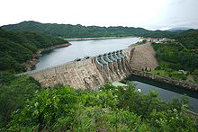
Location of Daecheong Dam
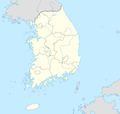
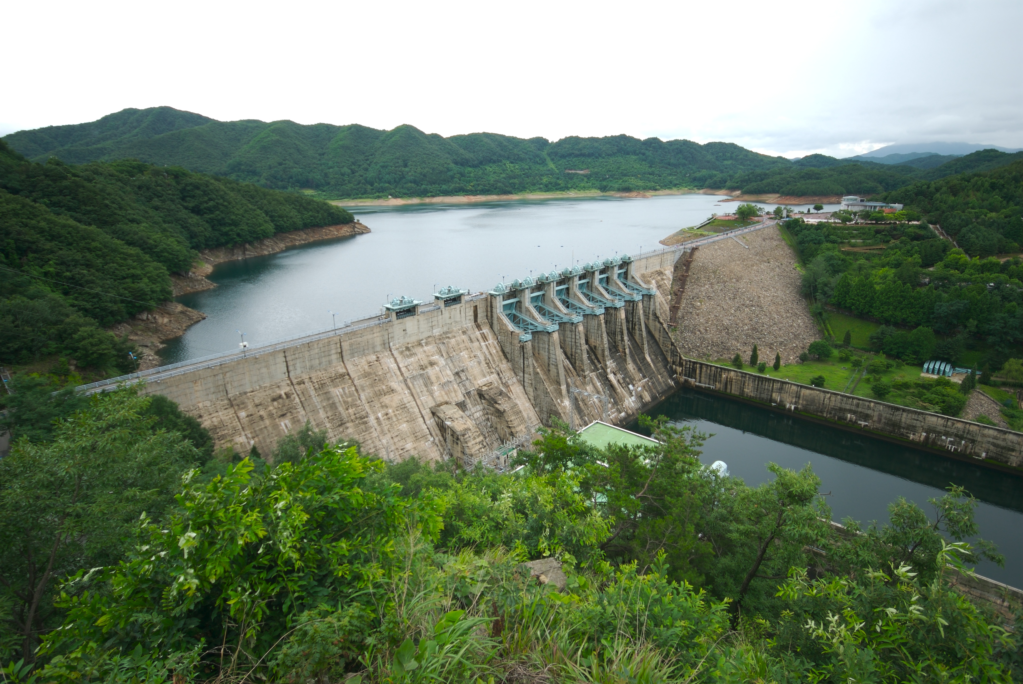
Country South Korea
Location Daejeon
Coordinates 36°28′39″N 127°28′51″E / 36.4775°N 127.48083°E / 36.4775; 127.48083Coordinates: 36°28′39″N 127°28′51″E / 36.4775°N 127.48083°E / 36.4775; 127.48083
Status Operational
Construction began 1975
Opening date 1980
Owner(s) Korea Water Resources Corporation
Dam and spillways
Type of dam Embankment and gravity
Height 72 m (236 ft)
Length 495 m (1,624 ft)
Impounds Geum River
Reservoir
Capacity 1,490,000,000 m3 (1,207,963 acre·ft)
Active capacity 790,000,000 m3 (640,463 acre·ft)
Surface area 72.8 km2 (28 sq mi)
Power station
Turbines 2 x 45 MW
Installed capacity 90 MW

The Daecheong Dam is a combination concrete gravity and embankment dam on the Geum River, 16 km (10 mi) north of Daejeon in South Korea. The purpose of the dam is flood control, water supply and hydroelectric power generation. Construction on the dam began in 1975 and was complete on December 1, 1980 with a ceremony. The 72 m (236 ft) tall rock-fill, central clay core dam withholds a reservoir of 1,490,000,000 m3 (1,207,963 acre·ft).[1][2]


See also

  • List of power stations in South Korea

References

  1. ^ "Multi-Purpose Dams". Korea Water Resources Corporation. http://english.kwater.or.kr/. Retrieved 4 August 2011. 
  2. ^ "대전 재발견-대청댐" (in Korean). Daejeon Libo. 14 October 2009. http://daejonilbo.com/news/newsitem.asp?pk_no=847078. Retrieved 4 August 2011. 

Wikimedia Foundation. 2010.

Игры ⚽ Нужно решить контрольную?

Look at other dictionaries:

  • List of museums in South Korea — This list is incomplete; you can help by expanding it. There are over 500 museums and galleries in South Korea.[1] Contents 1 National museums 2 Museums in Seoul …   Wikipedia

  • Кымган — Характеристика Длина 395 км Площадь бассейна 10 000 км …   Википедия

  • Korean War — Part of the Cold War …   Wikipedia

  • ROKS Cheonan sinking — Four photos show damage to the ROKS Cheonan clockwise from upper left: (1) stack damage; (2) front portion (port side) showing the break point; (3) water pressure marks on the hull bottom; (4) a large fragment is lifted from the sea. Date 26… …   Wikipedia

  • Naval Battle of the Han River (1951) — Naval Battle of the Han River Part of the Korean War …   Wikipedia

  • Battle of Inchon — Part of the Korean War …   Wikipedia

  • Blockade of Wonsan — Part of the Korean War An explosion destroys North Korean supplies during the blockade of Wonsan …   Wikipedia

  • Geum River — Infobox Korean name hangul=금강 hanja=錦江 rr=Geumgang mr=Kŭmgang The Geum gang River is located in South Korea. It is a major river that originates in Jangsu eub, North Jeolla Province. It flows northward through North Jeolla and North Chungcheong… …   Wikipedia

  • Ministry of Environment (South Korea) — Ministry of Environment, Republic of Korea 환경부 Agency overview Formed December 24, 1994[1] Jurisdiction Government of South Korea Headquarters Gw …   Wikipedia

  • Battle of Chosin Reservoir — Coordinates: 40°29′N 127°12′E / 40.483°N 127.2°E / 40.483; 127.2 (Chosin Reser …   Wikipedia

Share the article and excerpts

Direct link
Do a right-click on the link above
and select “Copy Link”