- D104 road (Croatia)
-
D104 state road
Route information Length: 10.1 km (6.3 mi) Major junctions From:  D102 near Malinska
To: Valbiska ferry port Location Counties: Primorje-Gorski Kotar Highway system State roads in Croatia
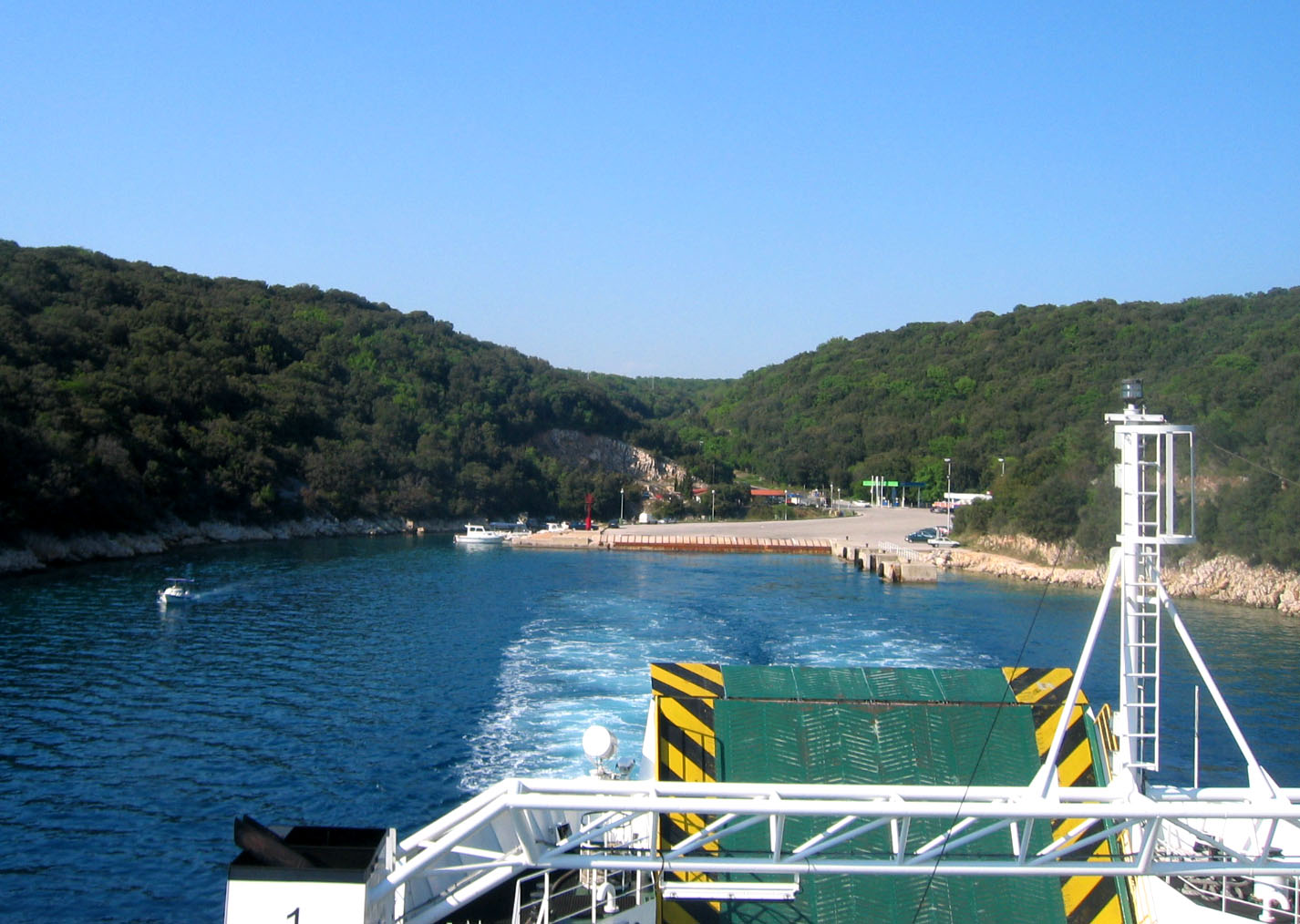
 Valbiska, at the southern terminus of D104
D104 branches off to the southwest from D102 near Malinska towards Valbiska ferry port - Jadrolinija ferry access to Merag, island of Cres[1] (D101) and LNP ferry access to Lopar, island of Rab[2] (D105). The road is 10.1 km long.[3]
The road, as well as all other state roads in Croatia, is managed and maintained by Hrvatske ceste, a state-owned company.[4]
Contents
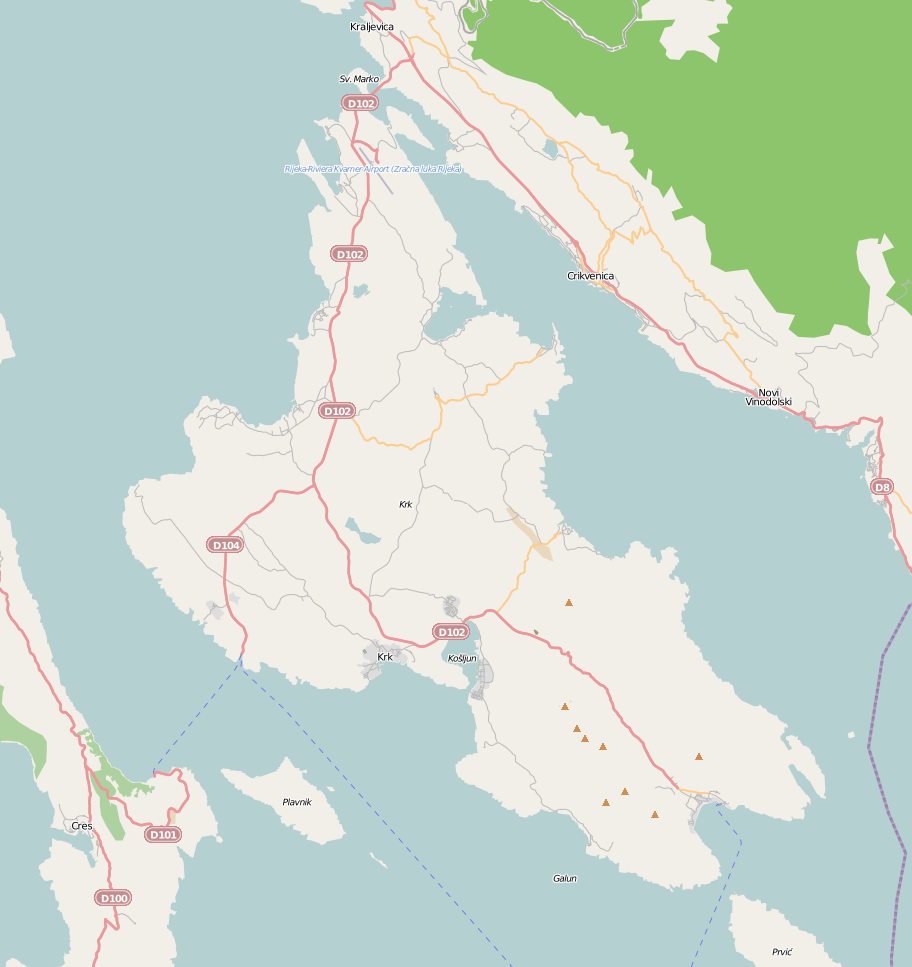
 Map of Krk showing D104
Traffic volume
D104 traffic is not counted directly, however the operator Hrvatske ceste reports the number of vehicles using ferry service flying from Valbiska port, accessed by the D104 road, thereby allowing the D104 traffic volume to be deduced.[5] Substantial variations between annual (AADT) and summer (ASDT) traffic volumes are attributed to the fact that the road serves as a connection carrying substantial tourist traffic to islands of Cres and Rab.
D104 traffic volume Road Counting site AADT ASDT Notes  D104
D104332 Valbiska-Merag ferry 958 1,976 Traffic to the island of Cres only. D104338 Valbiska-Lopar ferry 84 230 Traffic to the island of Rab only. D104Valbiska ferry port (total) 1,042 2,206 Total D104 traffic volume in Valbiska ferry port. Road junctions and populated areas
D104 junctions Type Slip roads/Notes  D102 to Rijeka, Crikvenica and A6 and A7 motorways (to the north) and Krk (to the south). Northern terminus of the road.
L58070 to Malinska to Stričići L58085 to Poljica and Vrh L58086 to Linardići and Vrh L58087 to Skrbčići L58088 to Pinezići 
Valbiska ferry port - Jadrolinija ferry access to Merag, island of Cres[1] (D101) and LNP ferry access to Lopar, island of Rab[2] (D105). Southern terminus of the road. Sources
- ^ a b "Jadrolinija ferry service" (in English). May 11, 2010. http://www.jadrolinija.hr/default.aspx?lang=2.
- ^ a b "LNP ferry service schedule" (in English). May 11, 2010. http://www.lnp.hr/plovidbeni-red.aspx?l=2.
- ^ "Decision on categorization of public roads as state roads, county roads and local roads" (in Croatian). Narodne novine. February 17, 2010. http://narodne-novine.nn.hr/clanci/sluzbeni/2010_02_17_410.html.
- ^ "Public Roads Act" (in Croatian). Narodne novine. December 14, 2004. http://narodne-novine.nn.hr/clanci/sluzbeni/2004_12_180_3130.html.
- ^ "Traffic counting on the roadways of Croatia in 2009 - digest" (in English). Hrvatske ceste. May 1, 2010. http://www.hrvatske-ceste.hr/WEB%20-%20Legislativa/brojenje-prometa/CroDig2009.pdf.
See also
- State roads in Croatia
- Hrvatske ceste
- Jadrolinija
External links
Categories:- State roads in Croatia
- Primorje-Gorski Kotar County

Wikimedia Foundation. 2010.