- Curralinho
-
Curralinho — Municipality — 
FlagLocation in the State of Pará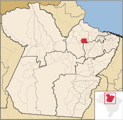
Coordinates: 01°48′50″S 49°47′42″W / 1.81389°S 49.795°WCoordinates: 01°48′50″S 49°47′42″W / 1.81389°S 49.795°W Country  Brazil
Region North State  Pará
ParáArea - Total 3,617.240 km2 (1,396.6 sq mi) Elevation 15 m (49 ft) Population (2008) - Total 26,864 - Density 6.5/km2 (16.8/sq mi) Time zone BST (UTC-3) Postal Code 68815-000 Curralinho is a Brazilian municipality located in the state of Pará. Its population as of 2008 is estimated to be 26,864 people. The area of the municipality is 3.617,240 km². The city belongs to the mesoregion Marajó and to the microregion of Furos de Breves.
Categories:- Populated places in Pará
- Pará geography stubs


Wikimedia Foundation. 2010.