- Hanwell Park
-
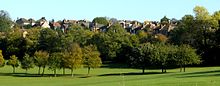 Part of Hanwell Park after its redevelopment for housing
Hanwell Park was a farming estate in west London. The estate was finally broken up by 1886 after Sir Montagu Sharpe had sold the holding he had inherited.[1]
Brent Valley golf club was formed from the estate of The Grove - a landed estate of 29 acres formed on the breakup of the much larger Hanwell Park estate in 1837 and enfranchised in 1860. Nearby is Cuckoo Hill, the site of a battle between Romano-British and Saxons in the sixth century known as Blood(y) Croft and this bloodshed is a suggested origin of the name Hanwell; haenwael being a slaughter on high ground. The graves of seven Saxon leaders were found on this site in 1886 along with broken spearheads. The land was then built upon with Edwardian housing in 1905 when the London United Tramways Company was at last allowed to run trams through Ealing borough in 1901, causing a further wave of housing development in the area.[2][3][4][5][6][7][8]
Hanwell Park house
Hanwell Park was a neoclassical house built in the 19th century.[9] John Henry Brady, in his 1838 guide A new pocket guide to London and its environs, described the estate as an "attractive seat"[10] whilst others noted that whilst it was not large it was situated in extensive grounds.[11] Sir Archibald Macdonald, once Chief Baron of the Exchequer had owned the house,[11] but it was demolished around 1928[9]
Maps
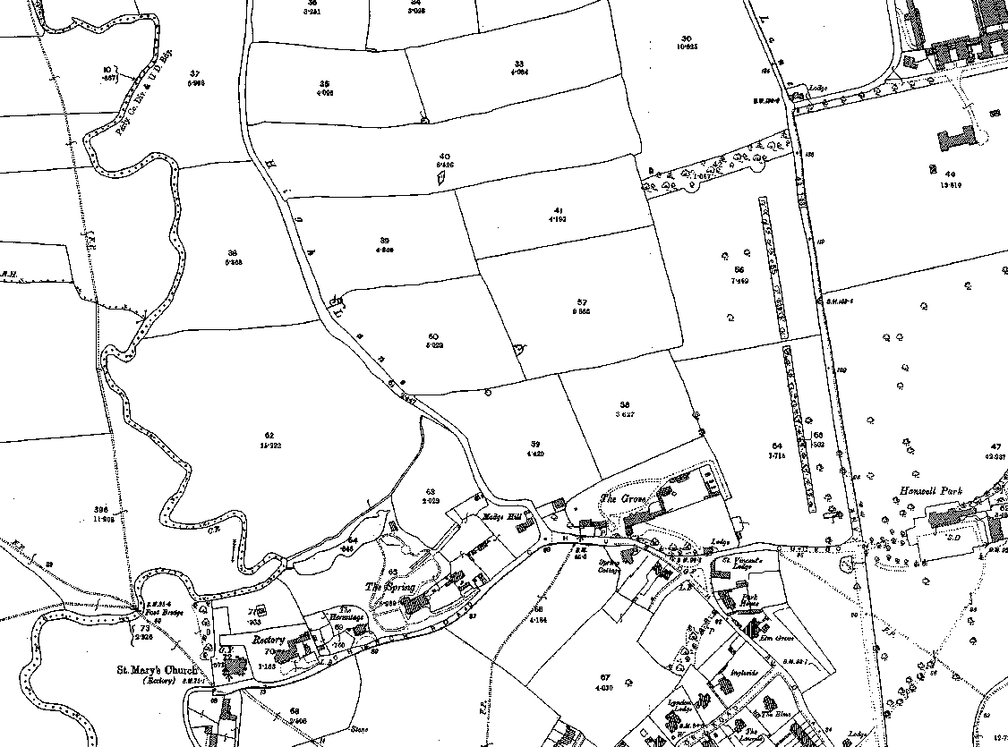
 Brent valley and Cuckoo Hill in 1894. The Grove is at bottom centre. This estate formed the golf course. To its left are other notable buildings such as The Spring and St. Mary's Church, Hanwell. The river Brent runs down the left side of the map. On the right side of the map are Hanwell Park and, above it, the substantial premises of the Central London District School which faced the northern leg of the avenue.
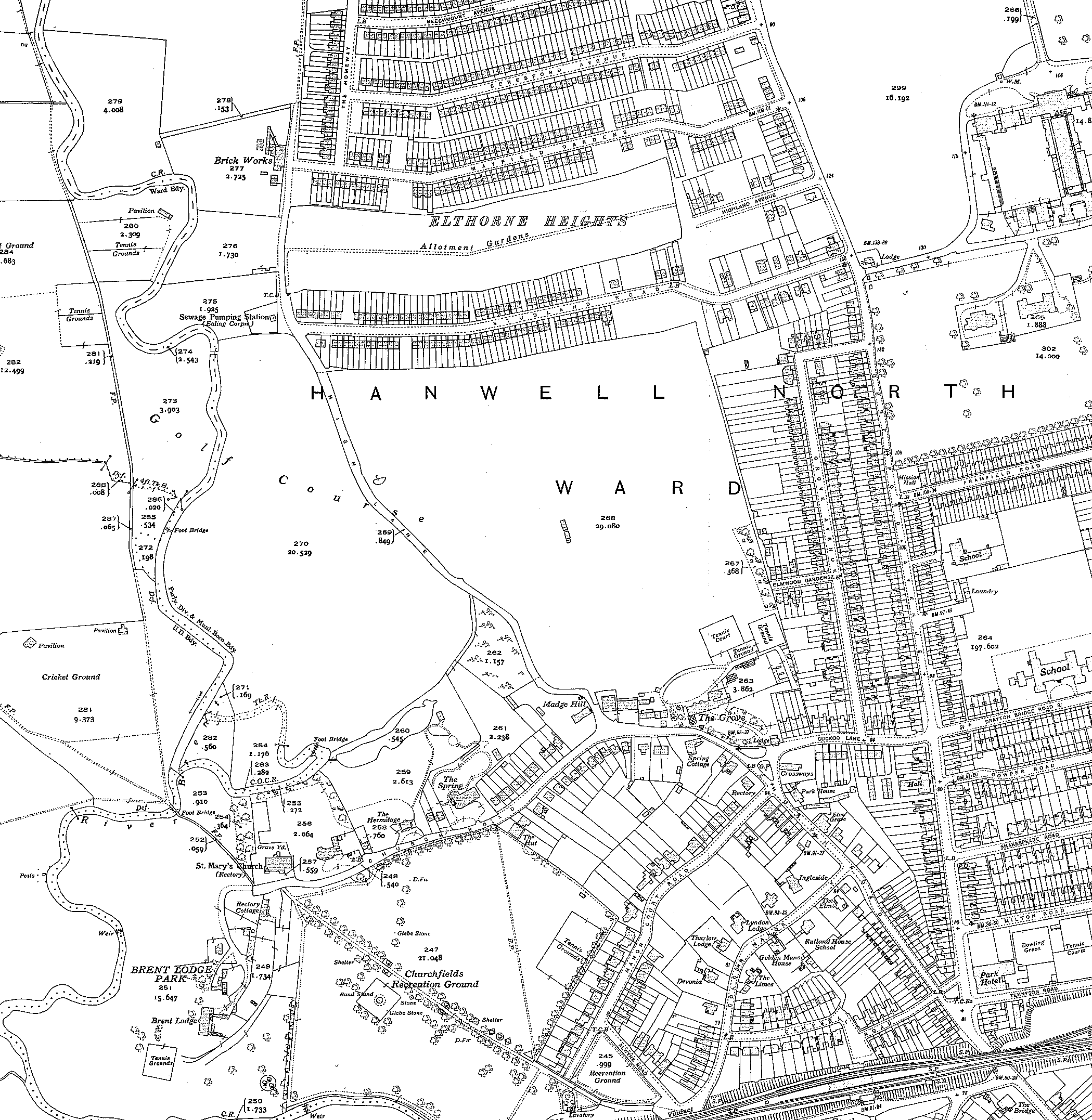
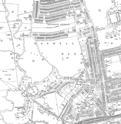 Brent valley and Cuckoo Hill in 1934. The Grove is now the clubhouse for the golf course and Grove Avenue has been built to the east. Hanwell railway station on the Great Western Railway is at the bottom of the map.
References
- ^ Reynolds, Susan (1962). 'Hanwell: Other estates', A History of the County of Middlesex: Volume 3: Shepperton, Staines, Stanwell, Sunbury, Teddington, Heston and Isleworth, Twickenham, Cowley, Cranford, West Drayton, Greenford, Hanwell, Harefield and Harlington. Victoria County History. pp. 225–226. http://british-history.ac.uk./report.aspx?compid=22341.
- ^ Jonathan Oates (2002), Southall and Hanwell, http://books.google.co.uk/books?id=YFaTAQAACAAJ
- ^ Montagu Sharpe (1919), Middlesex in British, Roman and Saxon times, G. Bell and Sons, p. 112, http://books.google.com/books?id=2L4OAAAAQAAJ&pg=PA152&dq=%22Bloody+Croft%22&hl=en&ei=uznGTPHEE8SHcbfGoKMO&sa=X&oi=book_result&ct=result&resnum=5&sqi=2&ved=0CDgQ6AEwBA#v=onepage&q=%22Bloody%20Croft%22&f=false
- ^ Cyril M. Neaves (1971), A history of Greater Ealing, p. 105, ISBN 9780854096794, http://books.google.com/books?id=C2-AAAAAIAAJ&q=%22Grove+Avenue%22,+Ealing&dq=%22Grove+Avenue%22,+Ealing&hl=en&ei=CzXGTNaGJ4X5ccHY3YMO&sa=X&oi=book_result&ct=result&resnum=2&sqi=2&ved=0CC8Q6AEwAQ
- ^ Geoffrey Hewlett (1979), A History of Wembley, p. 5, http://books.google.com/books?id=gNFAAAAAYAAJ&q=Blood+Croft+Hanwell&dq=Blood+Croft+Hanwell&hl=en&ei=kTjGTIHjMozJcfHcifMN&sa=X&oi=book_result&ct=result&resnum=2&ved=0CCwQ6AEwAQ
- ^ Directions and historical notes for Beating the Bounds of Hanwell, http://www.mazefind.co.uk/cgi-bin/cms/ohra.pl?content_id=1226580660&session_id=
- ^ Victoria County History of Middlesex
- ^ Sir Montague Sharpe (1924), Some account of bygone Hanwell and its Chapelry of New Brentford, http://books.google.co.uk/books?id=kBGpHAAACAAJ
- ^ a b Cherry, Bridget; Pevsner, Nikolaus (1991). Buildings of England: London 3: North West, Part 3. Penguin Books. pp. 804. ISBN 9780140710489. http://books.google.co.uk/books?id=8utUAAAAMAAJ&q=%22hanwell+park%22&dq=%22hanwell+park%22&hl=en&ei=uMjITLyTApi8jAeFn9BZ&sa=X&oi=book_result&ct=result&resnum=10&ved=0CF4Q6AEwCQ. Retrieved 28 October 2010.
- ^ Brady, John Henry (1838). A new pocket guide to London and its environs. Parker. http://books.google.co.uk/books?id=8g8HAAAAQAAJ&pg=PA336&dq=%22hanwell+park%22&hl=en&ei=F8nITMy6Ks6gOryRxPAI&sa=X&oi=book_result&ct=result&resnum=7&ved=0CEUQ6AEwBjgU#v=onepage&q=%22hanwell%20park%22&f=false.
- ^ a b Brayley, Edward Wedlake (1816). London and Middlesex: or, An historical, commercial, & descriptive survey of the metropolis of Great-Britain: including sketches of its environs, and a topographical account of the most remarkable places in the above county, Volume 4. Printed by W. Wilson, for Vernor, Hood, and Sharpe, 1816. http://books.google.co.uk/books?id=3flHAAAAMAAJ&pg=PA593&dq=%22hanwell+park%22&hl=en&ei=rsnITM2kKcOhOtTxpPAI&sa=X&oi=book_result&ct=result&resnum=7&ved=0CE0Q6AEwBg#v=onepage&q=%22hanwell%20park%22&f=false.
Categories:

Wikimedia Foundation. 2010.