- Cserhátsurány
-
Cserhátsurány is a village and municipality in the comitat of Nógrád, Hungary.
References
County seat: Salgótarján Cities and towns 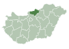
Villages Alsópetény · Alsótold · Bánk · Bárna · Becske · Bercel · Berkenye · Bér · Bokor · Borsosberény · Buják · Cered · Cserháthaláp · Cserhátsurány · Cserhátszentiván · Csesztve · Csécse · Csitár · Debercsény · Dejtár · Diósjenő · Dorogháza · Drégelypalánk · Ecseg · Egyházasdengeleg · Egyházasgerge · Endrefalva · Erdőkürt · Erdőtarcsa · Etes · Érsekvadkert · Felsőpetény · Felsőtold · Galgaguta · Garáb · Herencsény · Héhalom · Hollókő · Hont · Horpács · Hugyag · Iliny · Ipolytarnóc · Ipolyvece · Jobbágyi · Karancsalja · Karancsberény · Karancskeszi · Karancslapujtő · Karancsság · Kazár · Kálló · Keszeg · Kétbodony · Kisbágyon · Kisbárkány · Kisecset · Kishartyán · Kozárd · Kutasó · Legénd · Litke · Lucfalva · Ludányhalászi · Magyargéc · Magyarnándor · Márkháza · Mátramindszent · Mátranovák · Mátraszele · Mátraszőlős · Mátraterenye · Mátraverebély · Mihálygerge · Mohora · Nagybárkány · Nagykeresztúr · Nagylóc · Nagyoroszi · Nemti · Nézsa · Nógrád · Nógrádkövesd · Nógrádmarcal · Nógrádmegyer · Nógrádsáp · Nógrádsipek · Nógrádszakál · Nőtincs · Őrhalom · Ősagárd · Palotás · Patak · Patvarc · Piliny · Pusztaberki · Rákóczibánya · Rimóc · Romhány · Ságújfalu · Sámsonháza · Sóshartyán · Szalmatercs · Szanda · Szarvasgede · Szátok · Szendehely · Szente · Szécsénke · Szécsényfelfalu · Szilaspogony · Szirák · Szuha · Szurdokpüspöki · Szügy · Tar · Terény · Tereske · Tolmács · Vanyarc · Varsány · Vizslás · ZabarOther topics History · Geography · Government · Economy · Culture · TourismCategories:- Populated places in Nógrád county
- Hungary geography stubs

Wikimedia Foundation. 2010.