- Cruïlles, Monells i Sant Sadurní de l'Heura
-
Cruïlles, Monells i Sant Sadurní de l'Heura — Municipality — The old bell tower of Sant Sadurní de l'Heura. Location in Catalonia
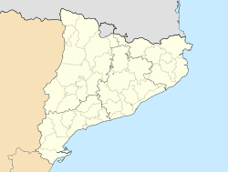
 Cruïlles, Monells i Sant Sadurní de l'Heura
Coordinates: 41°57′30″N 2°59′34″E / 41.95833°N 2.99278°ECoordinates: 41°57′30″N 2°59′34″E / 41.95833°N 2.99278°E Country  Spain
SpainCommunity  Catalonia
Province Girona Comarca Baix Empordà Government - Mayor Area - Total 9,983 km2 (3,854.5 sq mi) Elevation 110 m (361 ft) Population (2006) - Total 1,271 - Density 0.1/km2 (0.3/sq mi) Time zone CET (UTC+1) - Summer (DST) CEST (UTC+2) Cruïlles, Monells i Sant Sadurní de l'Heure is a municipality of the comarca (county) of Baix Empordà, formed in 1973 by merging the municipalities of Cruïlles, Monells, and Sant Sadurní de l'Heure. Sant Sadurní is the capital of the municipality.
The municipality has the longest toponym in Catalan at 43 characters.
Populated place Inhabitants Veïnat del Rissec 11 Veïnat de Sies 49 Veïnat de Sant Joan 3 Veïnat de la Font, el 12 Veïnat de Banyeres 31 Veïnat d'Estravau 4 Santa Pellaia 19 Sant Sadurní de l'Heura 174 Sant Miquel de Cruïlles 17 Sant Joan de Salelles 19 Sant Cebrià dels Alls 5 Sant Cebrià de Lledó 7 Rabioses, les 80 Puigventós 370 Monells 182 Cruïlles 250 Barri del Mas Savalls 0 Places of interest
- Church of Sant Sadurní de l'Heura
- Church of Santa Eulalia de Cruïlles
- Donjon of Cruïlles
- Church of Sant Genís de Monells
- Church of Sant Joan de Salelles
Demographics
Year Population 1497 233 1515 187 1553 220 1717 1,222 1787 1,419 1857 2,664 1877 2,184 1887 2,173 1900 1,877 1910 1,861 1920 1,766 1930 1,600 1940 1,482 1950 1,444 1960 1,382 1970 1,152 1981 1,056 1990 1,031 1992 1,073 1994 1,088 1996 1,099 1998 1,071 2000 1,096 2002 1,150 2004 1,201 2006 1,271 2009 - External links
Categories:- Baix Empordà
- Municipalities in Girona
- Populated places in Girona


Wikimedia Foundation. 2010.