- Crook Point Bascule Bridge
-
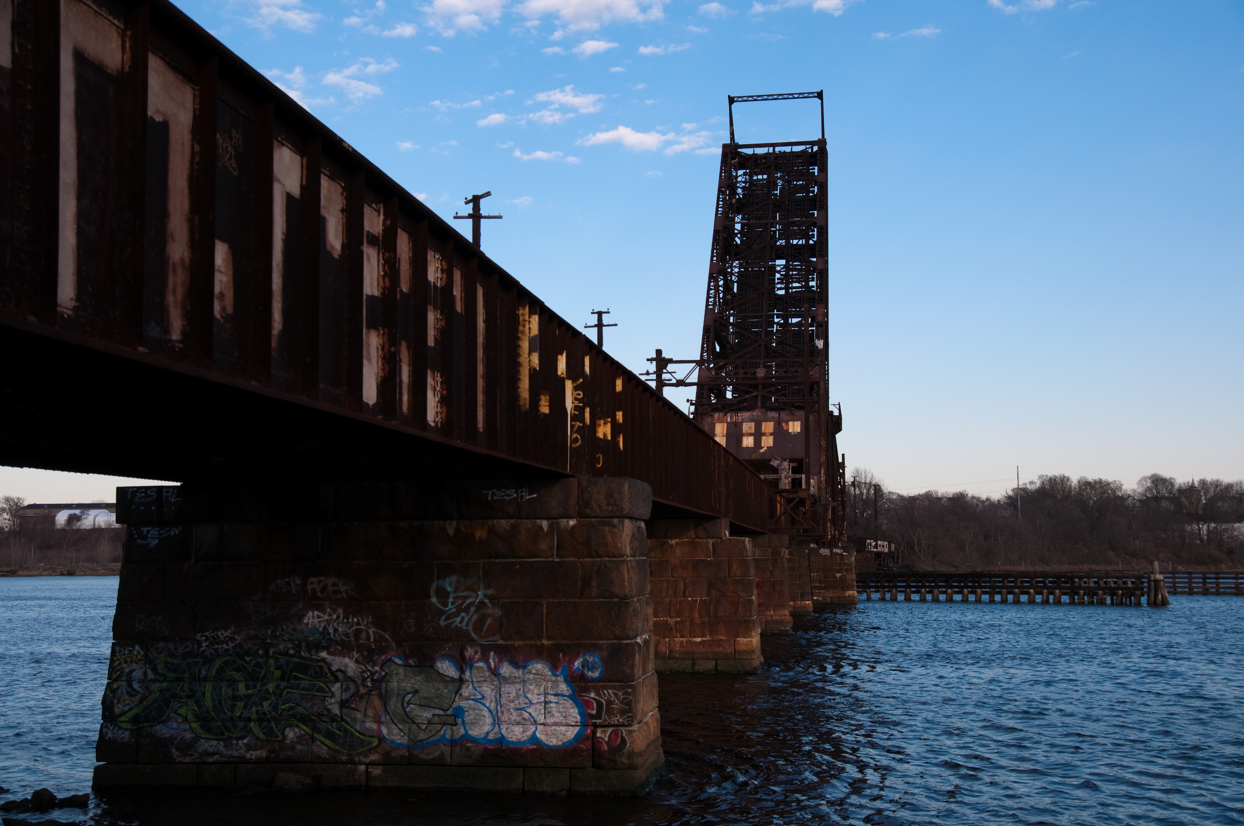
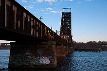 Seekonk River Drawbrige, Rhode Island 2009
The Crook Point Bascule Bridge (or the Seekonk River Drawbridge) is a defunct Scherzer rolling lift railway bridge which spans the Seekonk River, connecting the city of Providence, Rhode Island, to the suburb of East Providence. Stuck in the open position since its abandonment in 1976, it is known to nearby residents as the "Stuck-Up Bridge" and has become somewhat of a local icon of urban decay.[1]
Contents
History
Part of the East Side Railroad Tunnel project, the Crook Point Bascule Bridge was built in 1908 to provide a direct connection to the old Union Station along the New York, New Haven and Hartford Railroad line. It was designed by Sherzer Rolling Life Bridge Company of Chicago and measures 913 feet across, raises to a 64 degree angle, and opens a clear waterway 90 feet wide.[2] When railroad usage declined in the 1970s and plans were made to demolish Union Station, the East Side Railroad Tunnel and the Seekonk River Drawbridge were subsequently abandoned in 1976 with the bridge fixed in its current open position to allow river transit.
Decay
Since its abandonment, the bridge has been a target of graffiti, vandalism, and artistic and archaeological interest. The western entrance to the bridge is easily accessible from a dirt path off of an athletic field near the intersection of Gano and East George streets. Some wooden components of the tracks have rotted or burnt away, and various electrical cables have been disconnected, but the metal structure remains largely intact, albeit rusted. This combination of factors attracts various types of visitors to venture out onto the tracks and even climb up the drawbridge, despite highly dangerous conditions. Students from nearby colleges have also produced photography projects, documentaries, and studies featuring the bridge. One study by a Brown University archaeology student suggests that the bridge has functioned as a center of athletic initiation, punk counterculture gathering, and even suicide since 1976.[3]
Future
In 2003, Brown graduate Robert Manchester proposed a $30-million plan calling for the development of Crook Point, which includes the eastern landing of the bridge. Featured in his proposal were plans to reopen the bridge and tunnel as a light rail system, bringing commuters from East Providence to Thayer Street and downtown Providence.[4]
In May 2006, Mayor David Cicilline organized Transit 2020, an advisory group determined to find alternative transit solutions for Providence in order to overcome some limitations of RIPTA, on which it depends heavily. Included in Transit 2020's first report was an analysis describing the East Side Railroad Tunnel and Seekonk River Bridge line as a potential corridor for a light rail or bus rapid transit system.[5]
References
- ^ "Seekonk River Bridge". ArtInRuins.com. [1]
- ^ Sherzer, Albert H. Sherzer Rolling Lift Bridges. 1908. Chicago: Sherzer Rolling Lift Bridge Co. of Chicago
- ^ Doyle, James. "...Because It's There: Urbanism in the Archaeological Record". 17 Dec 2007 [2]
- ^ Dujardin, Richard. "Visions of a new East Providence waterfront". 13 July 2003 [3]
- ^ "Growing Smart with Transit." Transit 2020 Working Group. 2007. Pg. 11 [4]
External links
- 360-degree Interactive Panorama
- Rhode Island Art In Ruins: Seekonk River Bridge
- Urbanism in the Archaeological Record
- Transit2020.com
Coordinates: 41°49′26″N 71°23′06″W / 41.82379°N 71.38497°WCategories:- Railroad bridges in Rhode Island
- Bascule bridges
- Transportation in Providence, Rhode Island
Wikimedia Foundation. 2010.