Thoulcanna County

Thoulcanna County
Thoulcanna
New South Wales
Thoulcanna NSW.PNG
Location in New South Wales
Lands administrative divisions around Thoulcanna
Queensland Queensland Queensland
Delalah Thoulcanna Irrara
Ularara Ularara Barrona

Thoulcanna County is one of the 141 Cadastral divisions of New South Wales. It is located south of the border with Queensland, to the west of the Paroo River near Wanaaring in the Bourke Shire.

The name Thoulcanna is believed to be derived from a local Aboriginal word and is also the name of the local Thoulcanna Station.[1]

Parishes within this county

A full list of parishes found within this county; their current LGA and mapping coordinates to the approximate centre of each location is as follows:

Parish LGA Coordinates
Clear Water Unincorporated 29°22′42″S 144°17′32″E / 29.37833°S 144.29222°E / -29.37833; 144.29222 (Clear Water)
Colaine Unincorporated 29°33′01″S 143°42′38″E / 29.55028°S 143.71056°E / -29.55028; 143.71056 (Colaine)
Currabenya Unincorporated 29°06′35″S 143°44′49″E / 29.10972°S 143.74694°E / -29.10972; 143.74694 (Currabenya)
Davis Unincorporated 29°10′21″S 143°58′15″E / 29.1725°S 143.97083°E / -29.1725; 143.97083 (Davis)
Davison Unincorporated 29°22′43″S 143°41′57″E / 29.37861°S 143.69917°E / -29.37861; 143.69917 (Davison)
Eurimbula Unincorporated unknown
Evelyn Unincorporated 29°20′43″S 144°22′20″E / 29.34528°S 144.37222°E / -29.34528; 144.37222 (Evelyn)
Feehan Unincorporated 29°13′54″S 144°04′46″E / 29.23167°S 144.07944°E / -29.23167; 144.07944 (Feehan)
Flood Unincorporated 29°15′19″S 143°42′09″E / 29.25528°S 143.7025°E / -29.25528; 143.7025 (Flood)
Kelly Unincorporated 29°13′36″S 144°24′33″E / 29.22667°S 144.40917°E / -29.22667; 144.40917 (Kelly)
Kerrininna Unincorporated 29°10′07″S 144°23′25″E / 29.16861°S 144.39028°E / -29.16861; 144.39028 (Kerrininna)
Nardoo Unincorporated 29°31′56″S 144°08′49″E / 29.53222°S 144.14694°E / -29.53222; 144.14694 (Nardoo)
Newland Unincorporated 29°09′44″S 144°11′12″E / 29.16222°S 144.18667°E / -29.16222; 144.18667 (Newland)
Odonnell Unincorporated 29°13′46″S 144°15′27″E / 29.22944°S 144.2575°E / -29.22944; 144.2575 (Odonnell)
Stony Ridge Unincorporated 29°28′59″S 144°17′56″E / 29.48306°S 144.29889°E / -29.48306; 144.29889 (Stony Ridge)
Talyeale Unincorporated 29°01′21″S 144°07′50″E / 29.0225°S 144.13056°E / -29.0225; 144.13056 (Talyeale)
Waverley Unincorporated 29°06′01″S 143°58′16″E / 29.10028°S 143.97111°E / -29.10028; 143.97111 (Waverley)
Willera Unincorporated 29°26′38″S 143°53′50″E / 29.44389°S 143.89722°E / -29.44389; 143.89722 (Willera)
Yernca Bourke Shire 29°34′09″S 144°23′49″E / 29.56917°S 144.39694°E / -29.56917; 144.39694 (Yernca)

References

  1. ^ Geographical Names Board of NSW

Wikimedia Foundation. 2010.

Игры ⚽ Нужен реферат?

Look at other dictionaries:

  • Thoulcanna County, New South Wales — Infobox Australian cadastral name = Thoulcanna state = New South Wales caption = Location in New South Wales near nw = Queensland near n = Queensland near ne = Queensland near e = Irrara near se = Barrona near s = Ularara near sw = Ularara near w …   Wikipedia

  • Delalah County — Map of all coordinates from Google Map of all coordinates from Bing Export all coordinates as KML …   Wikipedia

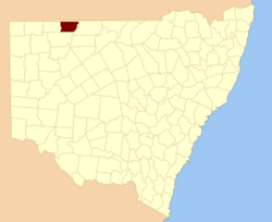
  • Delalah County, New South Wales — Infobox Australian cadastral name = Delalah state = New South Wales caption = Location in New South Wales near nw = Queensland near n = Queensland near ne = Queensland near e = Thoulcanna near se = Ularara near s = Ularara near sw = Yantara near… …   Wikipedia

  • Barrona County, New South Wales — Infobox Australian cadastral name = Barrona state = New South Wales caption = Location in New South Wales near nw = Thoulcanna near n = Irrara near ne = Gunderbooka near w = Ularara near e = Gunderbooka near sw = Fitzgerald near s = Landsborough… …   Wikipedia

  • Irrara County, New South Wales — Infobox Australian cadastral name = Irrara state = New South Wales caption = Location in New South Wales near nw = Queensland near n = Queensland near ne = Queensland near e = Culgoa near se = Gunderbooka near s = Barrona near sw = Ularara near w …   Wikipedia

  • Ularara County, New South Wales — Infobox Australian cadastral name = Ularara state = New South Wales caption = Location in New South Wales near nw = Delalah near n = Thoulcanna near ne = Irrara near e = Barrona near se = Landsborough near s = Fitzgerald near sw = Yantara near w …   Wikipedia

  • Barrona County — Map of all coordinates from Google Map of all coordinates from Bing Export all coordinates as KML …   Wikipedia

  • Irrara County — Map of all coordinates from Google Map of all coordinates from Bing Export all coordinates as KML …   Wikipedia

  • Ularara County — Map of all coordinates from Google Map of all coordinates from Bing Export all coordinates as KML …   Wikipedia

  • Lands administrative divisions of New South Wales — The 141 counties of New South Wales, with the original Nineteen shown in pink …   Wikipedia

Share the article and excerpts

Direct link
Do a right-click on the link above
and select “Copy Link”