Landsborough County

Landsborough County
Landsborough
New South Wales
Landsborough NSW.PNG
Location in New South Wales
Lands administrative divisions around Landsborough
Ularara Barrona Gunderbooka
Fitzgerald Landsborough Gunderbooka
Killara Rankin Yanda

Landsborough County is one of the 141 Cadastral divisions of New South Wales. It is located to the north-west of the Darling River.

Landsborough County was named in honour of the explorer William Landsborough (1825-1886).[1]

Parishes within this county

A full list of parishes found within this county; their current LGA and mapping coordinates to the approximate centre of each location is as follows:

Parish LGA Coordinates
Barcoola Bourke Shire 30°22′22″S 145°11′42″E / 30.37278°S 145.195°E / -30.37278; 145.195 (Barcoola)
Biparo Bourke Shire 30°15′24″S 144°15′33″E / 30.25667°S 144.25917°E / -30.25667; 144.25917 (Biparo)
Burry Gurry Bourke Shire 30°16′45″S 145°08′16″E / 30.27917°S 145.13778°E / -30.27917; 145.13778 (Burry Gurry)
Campamooka Bourke Shire 30°43′53″S 144°36′39″E / 30.73139°S 144.61083°E / -30.73139; 144.61083 (Campamooka)
Coolpooka Bourke Shire 30°21′58″S 144°51′38″E / 30.36611°S 144.86056°E / -30.36611; 144.86056 (Coolpooka)
Coonong Bourke Shire 30°27′10″S 144°32′46″E / 30.45278°S 144.54611°E / -30.45278; 144.54611 (Coonong)
Delta Bourke Shire 30°27′46″S 144°55′29″E / 30.46278°S 144.92472°E / -30.46278; 144.92472 (Delta)
Dunlop Bourke Shire unknown
Goolgumbla Bourke Shire 30°16′30″S 144°23′56″E / 30.275°S 144.39889°E / -30.275; 144.39889 (Goolgumbla)
Happy Valley Bourke Shire 30°20′05″S 145°00′49″E / 30.33472°S 145.01361°E / -30.33472; 145.01361 (Happy Valley)
Hora Bourke Shire 30°29′14″S 144°40′14″E / 30.48722°S 144.67056°E / -30.48722; 144.67056 (Hora)
Hylaman Bourke Shire 30°40′04″S 144°48′18″E / 30.66778°S 144.805°E / -30.66778; 144.805 (Hylaman)
Jung Jung Bourke Shire 30°38′21″S 144°39′46″E / 30.63917°S 144.66278°E / -30.63917; 144.66278 (Jung Jung)
Kapiti Bourke Shire unknown
Mulyah Bourke Shire 30°35′34″S 144°28′06″E / 30.59278°S 144.46833°E / -30.59278; 144.46833 (Mulyah)
Nalticomebee Bourke Shire 30°28′27″S 145°05′12″E / 30.47417°S 145.08667°E / -30.47417; 145.08667 (Nalticomebee)
Newfoundland Bourke Shire 30°49′25″S 144°39′52″E / 30.82361°S 144.66444°E / -30.82361; 144.66444 (Newfoundland)
Pelora Bourke Shire 30°18′48″S 144°39′46″E / 30.31333°S 144.66278°E / -30.31333; 144.66278 (Pelora)
Singoramba Bourke Shire 30°13′38″S 144°37′43″E / 30.22722°S 144.62861°E / -30.22722; 144.62861 (Singoramba)
Talowla Bourke Shire 30°17′32″S 145°14′15″E / 30.29222°S 145.2375°E / -30.29222; 145.2375 (Talowla)
Tindeanda Bourke Shire 30°23′14″S 144°17′33″E / 30.38722°S 144.2925°E / -30.38722; 144.2925 (Tindeanda)
Uliara Bourke Shire 30°21′21″S 145°20′41″E / 30.35583°S 145.34472°E / -30.35583; 145.34472 (Uliara)
Wilson Bourke Shire 30°10′10″S 144°54′54″E / 30.16944°S 144.915°E / -30.16944; 144.915 (Wilson)
Windoley Unincorporated 30°16′20″S 144°05′27″E / 30.27222°S 144.09083°E / -30.27222; 144.09083 (Windoley)
Yarramarra Bourke Shire 30°14′53″S 145°19′23″E / 30.24806°S 145.32306°E / -30.24806; 145.32306 (Yarramarra)

References

  1. ^ Geographical Names Board of NSW

Wikimedia Foundation. 2010.

Игры ⚽ Поможем написать реферат

Look at other dictionaries:

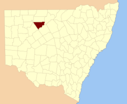
  • Landsborough County, New South Wales — Infobox Australian cadastral name = Landsborough state = New South Wales caption = Location in New South Wales near nw = Ularara near n = Barrona near ne = Gunderbooka near e = Gunderbooka near se = Yanda near s = Rankin near sw = Killara near w …   Wikipedia

  • County of Kara Kara — Kara Kara Victoria Location in Victoria Lands administrative divisions around Kara Kara …   Wikipedia

  • Gordon Landsborough — Born 1913 Yorkshire, England Died 1983 Occupation writer Gordon Holmes Landsborough, (1913–1983), English publisher, author and bookseller, was in the forefront of change in t …   Wikipedia

  • Fitzgerald County, New South Wales — Infobox Australian cadastral name = Fitzgerald state = New South Wales caption = Location in New South Wales near nw = Yantara near n = Ularara near ne = Barrona near e = Landsborough near se = Killara near s = Killara near sw = Yungnulgra near w …   Wikipedia

  • Killara County, New South Wales — Infobox Australian cadastral name = Killara state = New South Wales caption = Location in New South Wales near nw = Fitzgerald near n = Fitzgerald near ne = Landsborough near e = Yanda near se = Rankin near s = Werunda near sw = Young near w =… …   Wikipedia

  • Rankin County, New South Wales — Infobox Australian cadastral name = Rankin state = New South Wales caption = Location in New South Wales near nw = Killara near n = Landsborough near ne = Yanda near e = Robinson near se = Booroondarra near s = Woore near sw = Werunda near w =… …   Wikipedia

  • Fitzgerald County — Map of all coordinates from Google Map of all coordinates from Bing Export all coordinates as KML …   Wikipedia

  • Killara County — Map of all coordinates from Google Map of all coordinates from Bing Export all coordinates as KML …   Wikipedia

  • Barrona County, New South Wales — Infobox Australian cadastral name = Barrona state = New South Wales caption = Location in New South Wales near nw = Thoulcanna near n = Irrara near ne = Gunderbooka near w = Ularara near e = Gunderbooka near sw = Fitzgerald near s = Landsborough… …   Wikipedia

  • Gunderbooka County, New South Wales — Infobox Australian cadastral name = Gunderbooka state = New South Wales caption = Location in New South Wales near nw = Irrara near n = Culgoa near ne = Culgoa near e = Narran near se = Cowper near s = Yanda near sw = Landsborough near w =… …   Wikipedia

Share the article and excerpts

Direct link
Do a right-click on the link above
and select “Copy Link”