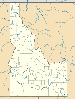
- Cottonwood Butte
-
Cottonwood Butte Location Idaho County,
Idaho
 United States
Nearest city Cottonwood Coordinates 46°0′0″N 116°30′0″W / 46°N 116.5°W Vertical 845 ft. - (258 m) Top elevation 5566 ft. - (1697 m) Base elevation 4721 ft. - (1439 m) Skiable area 260 acres (1.1 km2) Runs 7 Longest run 4000 ft. - (1219 m) Lift system 1 T-bar
1 rope towSnowfall 45" - (114 cm) Web site cottonwoodbutte.org location of Cottonwood Butte,
west of CottonwoodCottonwood Butte is a mountain and modest ski area in northern Idaho, west of nearby Cottonwood. Its summit is at an elevation of 5,730 feet (1,750 m) above sea level and is the highest point on the Camas Prairie, 2,100 feet (640 m) above Cottonwood.
Contents
Ski area
The summit of the ski lift is 5,566 feet (1,697 m), with a vertical drop of 845 feet (258 m). The slopes are on the northeast flank of the mountain, served by two surface lifts: a T-bar and a rope tow. The average snowfall is 45 inches (110 cm).
The ski area was established in 1967,[1] although skiing had previously taken place on the mountain with portable ski tows.[2]
Radar station
During the Cold War, Cottonwood Butte was the site of a U.S. Air Force early warning radar station, which went on-line in early 1959.[3] The radar tower was at the summit and the support buildings and living quarters were below the present base of the ski area, at 4,400 feet (1,300 m). The radar was significantly upgraded with a new tower in 1962,[4] but the station was obsolete within three years and was deactivated.[5] The buildings became a Job Corps center in 1965, supervised by the U.S. Forest Service.
Correctional facility
After nine years, the Job Corps center was transferred to the state of Idaho in 1974, and was converted to the minimum-security North Idaho Correctional Institution.[6][7]
The state department of lands built a fire lookout at the summit, which also supports various communications towers.[8]
References
- ^ Lewiston Morning Tribune - New ski area will include Empire's two longest runs - 1967-11-22 - p.9
- ^ Lewiston Morning Tribune - Cottonwood ski area to get portable tow - 1957-12-10 - p.8
- ^ Spokesman-Review - Cottonwood radar unit is readied - 1958-11-30 - p.18
- ^ Lewiston Morning Tribune - Cottonwood Butte monster to be clad in a cocoon - 1962-03-25 - sec.2, p.3
- ^ Lewiston Morning Tribune - Memory of Cottonwood Butte will go with major to Thailand - 1965-05-17 - p.8
- ^ Lewiston Morning Tribune - State signs lease on Job Corps site - 1974-11-15 - p.16A
- ^ Idaho Department of Corrections - North Idaho Correctional Institution - accessed 2011-11-21
- ^ Lewiston Morning Tribune - Anyone for the road? - 1995-08-10 - p.5A
External links
- Cottonwood Butte.org - ski area
- Go-Idaho.com - Cottonwood Butte
- Visit Idaho.org - Cottonwood Butte
- North Central Idaho.info - Cottonwood Butte
- Idaho Ski Resorts.com - Cottonwood Butte
- MSRmaps.com - USGS topo map & aerial photo
Bald Mountain Ski Area | Bogus Basin | Brundage Mountain | Cottonwood Butte | Kelly Canyon | Little Ski Hill | Lookout Pass | Lost Trail Powder Mountain | Magic Mountain Resort | Pebble Creek | Pomerelle | Schweitzer Mountain | Silver Mountain | Snowhaven | Soldier Mountain | Sun Valley (Bald Mtn., Dollar Mtn.) | Tamarack Resort Cross country areas Heli Skiing Defunct Ski Areas Categories:- Ski areas and resorts in Idaho
- Landforms of Idaho County, Idaho
- Buildings and structures in Idaho County, Idaho
- Visitor attractions in Idaho County, Idaho
Wikimedia Foundation. 2010.

