- Cottbus (Bezirk)
-
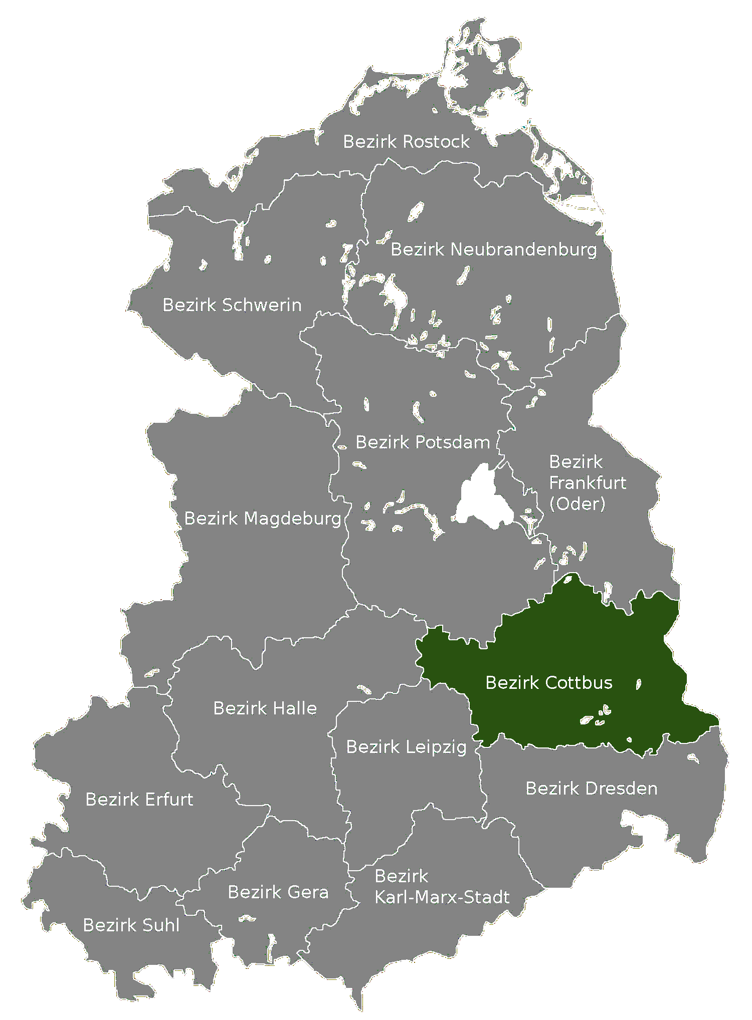
Bezirk Cottbus — District — Location of Bezirk Cottbus within the German Democratic Republic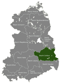
Coordinates: 51°45′N 14°10′E / 51.75°N 14.167°E Country German Democratic Republic Subdivisions 14 Kreise and 1 Stadtkreis Formed 1952 Dissolved 1990 Seat Cottbus Area - Total 8,262 km2 (3,190 sq mi) Population (1989)[1] - Total 884,700 - Density 107.1/km2 (277.3/sq mi) Vehicle registration Z The Bezirk Cottbus was a district (Bezirk) of East Germany. The administrative seat and the main town was Cottbus.
Contents
History
The district was established, with the other 13, on July 25, 1952, substituting the old German states. After October 3, 1990, it was disestablished due to the German reunification, becoming again part of the state of Brandenburg, excepted for the area of Hoyerswerda.
Geography
Position
The Bezirk Cottbus, mainly located in Brandenburg and partly in Saxony (Hoyerswerda), bordered with the Bezirke of Frankfurt (Oder), Potsdam, Halle, Leipzig and Dresden. It bodered also with Poland.
Subdivision
The Bezirk was divided into 15 kreise: 1 urban district (Stadtkreis) and 14 rural districts (Landkreise):
- Urban district : Cottbus.
- Rural districts : Bad Liebenwerda; Calau; Cottbus-Land; Finsterwalde; Forst; Guben; Herzberg; Hoyerswerda; Jessen; Luckau; Lübben; Senftenberg; Spremberg; Weißwasser.
References
- ^ "40 Jahre DDR", National central administration for statistics, May 1989
External links
 Media related to Bezirk Cottbus at Wikimedia Commons
Former Bezirke in East Germany  East Berlin (independent) · Cottbus · Dresden · Erfurt · Frankfurt (Oder) · Gera · Halle · Karl-Marx-Stadt · Leipzig · Magdeburg · Neubrandenburg · Potsdam · Rostock · Schwerin · Suhl
 Categories:
- Districts of East Germany
- History of Brandenburg
- History of Saxony
- 1952 establishments
- 1990 disestablishments
Wikimedia Foundation. 2010.