- Coto Laurel
-
Barrio Coto Laurel Location of barrio Coto Laurel within the municipality of Ponce shown in red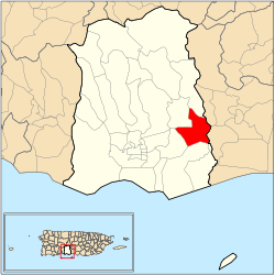
Country  United States
Territory  Puerto Rico
Municipality  Ponce
PonceArea - Total 3.66 sq mi (9.5 km2) - Land 3.60 sq mi (9.3 km2) - Water 0.06 sq mi (0.2 km2) Population (2000) - Total 5,285 - Density 1,493/sq mi (576.5/km2) Source: 2000 Census Coto Laurel (Barrio Coto Laurel) is one of the 31 barrios of the municipality of Ponce, Puerto Rico. Along with Anón, Marueño, Guaraguao, Quebrada Limon, Real, and San Patricio, and the coastal barrios of Canas and Capitanejo, Coto Laurel is one of the municipality's nine bordering barrios. It borders the municipality of Juana Diaz.
Contents
Location
Coto Laurel is a suburban barrio located in the southeastern section of the municipality, east of the traditional center of the city, Plaza Las Delicias.
Boundaries
It is bounded on the north by Río Inabón and Lake Number 5, on the south by Esperanza Street, on the west by PR-10 (roughly), and on the east by Río Inabón.[1] In terms of barrio-to-barrio boundaries, Coto Laurel is bounded in the north by Cerrillos and Real, in the south by Vayas, in the west by Sabanetas and Cerrillos, and in the east by the municipality of Juana Díaz.
Features and demographics
Coto Laurel has 3.60 square miles (9.3 km2) of land area and 0.06 square miles (160,000 m2) of water area. In 2000, the population of Coto Laurel was 5,285.[2] The population density in Coto Laurel was 1,468.1 persons per square mile.[3]
The communities of Palmarejo, Llanos del Sur, and El Monte are found in Coto Laurel. Lake Giles is also in Coto Laurel. Coto Laurel is crossed by Puerto Rico's superhighway PR-52. PR-14 also serves Coto Laurel.
Notable landmarks
Coto Laurel is home to world-renown Vassallo Industries, and San Cristobal Hospital, one of Ponce's major hospitals. Coto Laurel's picturesque village square was built under the administration of mayor José G. Tormos Vega in 1980.
Coordinates: 18°02′13″N 66°33′17″W / 18.0370384°N 66.5545960°W[4]
References
- ^ General Purpose Population Data, Census 2000. Unidad de Sistemas de Información Geográfica, Área de Tecnología de Información Gubernamental, Oficina de Gerencia y Presupuesto. Gobierno de Puerto Rico. Retrieved February 17, 2010.
- ^ Population
- ^ City Melt Retrieved, February 18, 2010.
- ^ U.S. Geological Survey Geographic Names Information System: Coto Laurel Barrio
Categories:- Barrios of Ponce

Wikimedia Foundation. 2010.