- Congo Town Airport
-
Congo Town Airport
South Andros AirportIATA: COX – ICAO: MYAK Summary Airport type Public Operator Government Serves Congo Town, Andros Island, Bahamas Elevation AMSL 15 ft / 5 m Coordinates 24°09′32″N 077°35′23″W / 24.15889°N 77.58972°WCoordinates: 24°09′32″N 077°35′23″W / 24.15889°N 77.58972°W Map Location in The Bahamas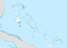
 MYAK
MYAKRunways Direction Length Surface m ft 10/28 1,623 5,325 Asphalt Source: DAFIF[1][2] Congo Town Airport (IATA: COX, ICAO: MYAK) is an airport near Congo Town in South Andros, part of Andros Island in The Bahamas.[2] It is also known as South Andros Airport (IATA: TZN).[3]
Facilities
The airport resides at an elevation of 15 ft (4.6 m) above mean sea level. It has one runway designated 10/28 with a asphalt surface measuring 1,623 × 30 m (5,325 × 98 ft).[1]
References
- ^ a b Airport information for MYAK at World Aero Data. Data current as of October 2006.Source: DAFIF.
- ^ a b Airport information for COX at Great Circle Mapper. Source: DAFIF (effective Oct. 2006).
- ^ Airport information for TZN at Great Circle Mapper.
External links
Categories:- Airports in the Bahamas
- Andros, Bahamas
- North American airport stubs
- Bahamas geography stubs

Wikimedia Foundation. 2010.