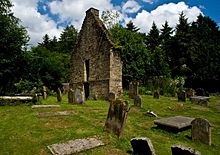
Clachan — CLACHAN, a village, chiefly in the parish of Campsie, but partly in that of Fintry, county of Stirling, 2 miles (W.) from Lennoxtown; containing 191 inhabitants. This village, called the Clachan of Campsie, is romantically situated in the… … A Topographical dictionary of Scotland
Clachan — A clachan (Irish: clochán, pronounced [kʰl̪ˠoxɑːn] or clachan, pronounced [kʰl̪ˠɑxɘn]; Scottish Gaelic: clachan, [kʰl̪ˠaxan]; Manx: claghan, pronounced [kʰl̪ˠaxan]) is a type of small traditional settlement common in Ireland and… … Wikipedia
Campsie — CAMPSIE, a parish, in the county of Stirling, 3½ miles (E.) from Strathblane; containing, with the villages of Birdstone, Haugh head, Lennoxtown, Milton, Torrance, and the Clachan, 6402 inhabitants. This parish, previously to the year 1649,… … A Topographical dictionary of Scotland
List of places in East Dunbartonshire — This List of places in East Dunbartonshire is a list of links for any town, village, hamlet, golf course, historic house, nature reserve, reservoir, river, canal and other place of interest in East Dunbartonshire, Scotland, UK.compactTOC NOTOC… … Wikipedia
East Dunbartonshire — infobox Scotland council area Council= East Dunbartonshire Siorrachd Dhùn Bhreatainn an Ear SizeRank= 26th Size= 175 km² Water= ? AdminHQ= Kirkintilloch ISO= GB EDU ONS= 00QL PopulationRank= 20th PopulationDate= 2004 Population= 106,550… … Wikipedia
Fintry — FINTRY, a parish, in the county of Stirling, 17 miles (N.) from Glasgow; containing, with the villages of Gonochan and Newtown, and the Clachan, 884 inhabitants. This parish is said to have derived its name from Gaelic terms signifying Fair… … A Topographical dictionary of Scotland
Lennoxtown — LENNOXTOWN, a village, in the parish of Campsie, county of Stirling, 3 miles (N. W. by W.) from Kirkintilloch; containing 2821 inhabitants. This is a considerable place, situated in the centre of the parish, and deriving its name from the… … A Topographical dictionary of Scotland
Drymen — Koordinaten 56° 4′ N, 4° 27′ W … Deutsch Wikipedia
Drymen — The Square, Drymen Drymen Coordinates … Wikipedia
 St Machan's Church
