- Circo Massimo (Rome Metro)
-
Circo Massimo

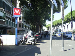
Station statistics Coordinates 41°53′01″N 12°29′17″E / 41.88361°N 12.48806°ECoordinates: 41°53′01″N 12°29′17″E / 41.88361°N 12.48806°E Structure Underground Other information Opened 1955 Owned by Atac di Roma Services Preceding station Rome Metro Following station Piramidetoward LaurentinaLine B toward RebibbiaCirco Massimo is a station on Line B of the Rome Metro. It was opened on 10 February 1955 and is sited at the east end of the Circus Maximus, after which it is named, near the headquarters of the FAO, originally built as the Ministero delle Colonie. Until 2002 the Obelisk of Axum also stood near the station. It has two separate exits on either side of the viale Aventino.
Surroundings
- Porta Capena
- Baths of Caracalla
- Passeggiata Archeologica
- Aventino
- Via dei Cerchi
- Roseto comunale
- rione San Saba
- Viale Aventino
- Stadio delle Terme
Churches
- Santa Balbina all'Aventino
- Santa Sabina
- Santi Alessio e Bonifacio
- Santa Prisca
- San Saba
- San Gregorio al Celio
External links
 Media related to Metropolitana di Roma linea B - Circo Massimo at Wikimedia Commons
Rome Metro Line A Battistini • Cornelia • Baldo degli Ubaldi • Valle Aurelia • Cipro • Ottaviano • Lepanto • Flaminio • Spagna • Barberini • Repubblica • Termini • Vittorio Emanuele • Manzoni • San Giovanni • Re di Roma • Ponte Lungo • Furio Camillo • Colli Albani – Parco Appia Antica • Arco di Travertino • Porta Furba – Quadraro • Numidio Quadrato • Lucio Sestio • Giulio Agricola • Subaugusta • Cinecittà • AnagninaLine B Laurentina • EUR Fermi • EUR Palasport • EUR Magliana • Marconi • Basilica San Paolo • Garbatella • Piramide • Circo Massimo • Colosseo • Cavour • Termini • Castro Pretorio • Policlinico • Bologna • Tiburtina • Quintiliani • Monti Tiburtini • Pietralata • Santa Maria del Soccorso • Ponte Mammolo • Rebibbia
Line B1 (Under Construction)Line C
(Opens 2011)San Giovanni(2013) • Lodi(2012) • Pigneto • Malatesta • Teano • Gardenie • Mirti • Parco di Centocelle(2011) • Alessandrino • Torre Spaccata • Torre Maura • Giardinetti • Torrenova • Torre Angela • Torre Gaia • Grotte Celoni • Due Leoni-Fontana Candida • Borghesiana • Bolognetta • Finocchio • Graniti • Montecompatri - Pantano(2011)Line D
(Proposed)Proposed
This Rome Metro article is a stub. You can help Wikipedia by expanding it.

