- Church of St John the Baptist, Yeovil
-
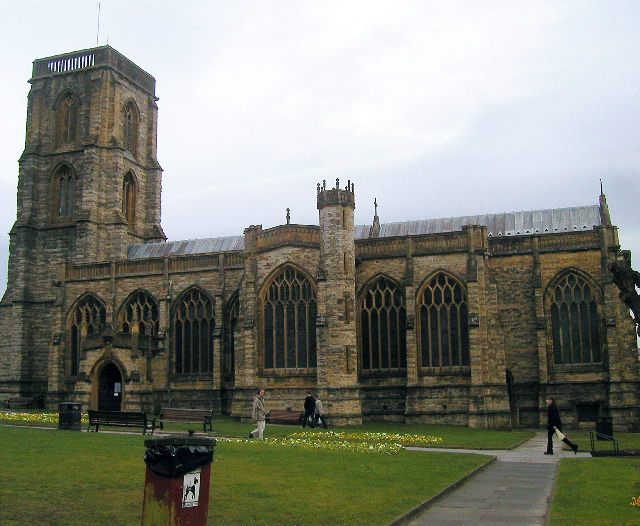
Church of St John the Baptist 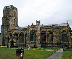
Location: BA20 1HE, Yeovil, Somerset, England Coordinates: 50°56′30″N 2°37′53″W / 50.94167°N 2.63139°WCoordinates: 50°56′30″N 2°37′53″W / 50.94167°N 2.63139°W Built: Late 14th century Listed Building – Grade I Designated: 19 March 1951[1] Reference #: 261341 
 Location of Church of St John the Baptist in Somerset
The Church of St John the Baptist in Yeovil, Somerset, England was built in the late 14th century and has been designated as a Grade I listed building.[1]
The tower, which was built around 1480,[2] is 92 feet (28 m) high, in 4-stages with set back offset corner buttresses. It is thought that the work was supervised by William Wynford, master mason of Wells.[1] To meet the growing size of Yeovil and the increased population, work on Holy Trinity Church began on 24 June 1843[3] to relieve the pressures on St John the Baptist church. In 1863, pressures on space in the graveyard were alleviated by the opening of Preston Road cemetery.
The church is capped by openwork balustrading matching the parapets which are from the 19th century, when major reconstruction work was undertaken from 1851-1860.[3] There are two-light late 14th century windows on all sides at bell-ringing and bell-chamber levels, the latter having fine pierced stonework grilles. There is a stair turret to the north-west corner, with a Weather vane termination.[1] The tower contains two bells dating from 1728 and made by Thomas Bilbie of the Bilbie family in Chew Stoke. The "Great Bell" was recast from 4,502 pounds (2,042 kg; 321.6 st) to 4,992 lb (2,264 kg; 356.6 st).[4]
See also
- List of Grade I listed buildings in South Somerset
- List of towers in Somerset
References
- ^ a b c d "Church of St John The Baptist". Listed Buildings Online. English Heritage. http://www.heritagegateway.org.uk/Gateway/Results_Single.aspx?uid=261341&resourceID=5. Retrieved 5 December 2010.
- ^ Poyntz Wright, Peter (1981). The Parish Church Towers of Somerset, Their construction, craftsmanship and chronology 1350 - 1550. Avebury Publishing Company. ISBN 0861275020.
- ^ a b http://www.yeovil-history.org.uk/johnbaptist.html
- ^ Moore, James; Roy Rice & Ernest Hucker (1995). Bilbie and the Chew Valley clock makers. The authors. ISBN 0952670208.
Categories:- Church of England churches in Somerset
- 14th-century architecture
- Grade I listed churches
- Grade I listed buildings in Somerset
- Yeovil

Wikimedia Foundation. 2010.