- Chorweiler
-
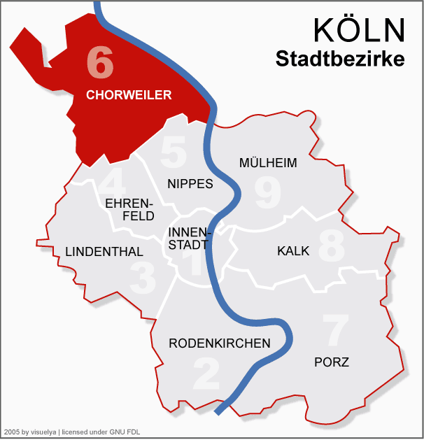
Chorweiler — 6th District of Cologne — view of Rheinkassel in Merkenich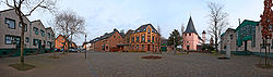 Location of Chorweiler shown in red
Country Germany Federal state North Rhine-Westphalia City Cologne Area - Total 67.2 km2 (25.9 sq mi) Population (December 2008) - Total 80,870 - Density 1,204/km2 (3,118.3/sq mi)  1970s Chorweiler
Chorweiler (German: Köln-Chorweiler) is the Sixth city district (Stadtbezirk) of Cologne, Germany. Large portion of the district of Chorweiler were incorporated into the city of Cologne in 1922, the quarter of Chorweiler was created in the 1970s. The district has the lowest population density in Cologne and many areas are very rural.
The District of Chorweiler borders with the Cologne boroughs of Nippes and Ehrenfeld to the South, Rhein-Erft-Kreis to the West, Rhein-Kreis Neuss to the North, and the Rhine to the West. On the other riverbank lies the city of Leverkusen.
Contents
Subdivisions
Chorweiler consists of twelve Stadtteile (city parts):
# City part Population (2009) Area (km²) Pop. per km² map 601 Merkenich 5,681 12,2 466 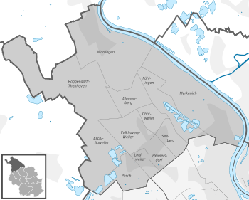
602 Fühlingen 2,103 4,94 426 603 Seeberg 11,303 1,78 6,347 604 Heimersdorf 5,859 1,75 3,357 605 Lindweiler 3,487 1,16 3,014 606 Pesch 7,621 2,83 2,689 607 Esch/Auweiler 6,455 7,61 848 608 Volkhoven/Weiler 6,016 4,35 1,382 609 Chorweiler 12,986 1,92 6,766 610 Blumenberg 5,894 3,22 1,829 611 Roggendorf/Thenhoven 3,839 13,8 279 612 Worringen 9,215 11,7 786 source: Die Kölner Stadtteile in Zahlen 2010 (German) Transportation
Main article: Transport in CologneChorweiler is served by numerous railway stations and highway. Train station include Köln-Chorweiler, Köln-Chorweiler Nord, Köln-Volkhovener Weg and Köln-Worringen, as well as numerous light rail stations of Cologne Stadtbahn line 12 and 15. The Bundesautobahn 57 connects Chorweiler with the Cologne Beltway.
Rhine bridges
 Leverkusener Brücke
External links
- Official webpage of the district (German)
Districts of Cologne I. Innenstadt · II. Rodenkirchen · III. Lindenthal · IV. Ehrenfeld · V. Nippes · VI. Chorweiler · VII. Porz · VIII. Kalk · IX. Mülheim Categories:
- North Rhine-Westphalia geography stubs
- Boroughs and quarters of Cologne


Wikimedia Foundation. 2010.