- Chickasaw Municipal Airport
-
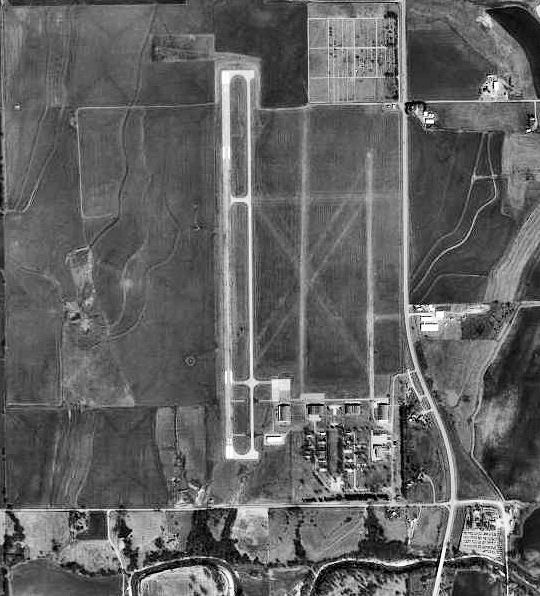
Chickasaw Municipal Airport 
1995 USGS image IATA: CHK – ICAO: KCHK Summary Airport type Public Owner City of Chickasha Location Grady County, near Chickasha, Oklahoma Elevation AMSL 1,152 ft / 351 m Coordinates 35°05′50″N 097°58′03″W / 35.09722°N 97.9675°WCoordinates: 35°05′50″N 097°58′03″W / 35.09722°N 97.9675°W Runways Direction Length Surface ft m 17/35 5,101 1,555 Asphalt 18/36 2,840 866 Turf 02/20 2,525 770 Turf Chickasha Municipal Airport (IATA: CHK, ICAO: KCHK) is a public airport located approximately 4 miles (6.4 km) north-northwest of Chickasha, Oklahoma. It provides general aviation service.
Contents
History
Opened in October, 1941 as Wilson-Bonifils Field, the airport conducted contract basic flying training for the United States Army Air Forces. The contractor was the Wilson-Bonfils Flying Schools. Flying training was performed with Fairchild PT-19s as the primary trainer. Also had several PT-17 Stearmans and a few P-40 Warhawks assigned. The wartime airport had up to six grass runways, with the runways being changed at various times.
Appears that there may have been four auxiliaries associated with Chickasha - Aux #1, Aux #2, Aux #3 & Aux #4 but unconfirmed and location unknown.
Inactivated on 1 May 1945 with the drawdown of AAFTC's pilot training program. The airfield was turned over to civil control at the end of the war though the War Assets Administration (WAA).
See also
References
 This article incorporates public domain material from websites or documents of the Air Force Historical Research Agency.
- Shaw, Frederick J. (2004), Locating Air Force Base Sites History’s Legacy, Air Force History and Museums Program, United States Air Force, Washington DC, 2004.
- Manning, Thomas A. (2005), History of Air Education and Training Command, 1942–2002. Office of History and Research, Headquarters, AETC, Randolph AFB, Texas ASIN: B000NYX3PC
External links
- FAA Terminal Procedures for CHK, effective 20 October 2011
- Resources for this airport:
- AirNav airport information for CHK
- FlightAware airport information and live flight tracker
- SkyVector aeronautical chart for CHK
 Army Air Forces Training Command
Flying Training Flying Schools Eastern Flying Training Command · Central Flying Training Command · Western Flying Training CommandSpecialized Schools Bombardier · Contract Flying · Glider Training · Gunnery · Navigator
Technical Training Eastern Technical Training Command · Central Technical Training Command · Western Technical Training CommandCategories:- 1941 establishments
- USAAF Contract Flying School Airfields
- Airfields of the United States Army Air Forces in Oklahoma
- Buildings and structures in Grady County, Oklahoma

Wikimedia Foundation. 2010.