- Chehour
-
Chehour
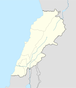
شحور— Town — Nickname(s): Dar El Ezz (Arabic:دار العز) Coordinates: 33°18′N 35°22′E / 33.3°N 35.367°ECoordinates: 33°18′N 35°22′E / 33.3°N 35.367°E Country Lebanon Governorate South Governorate District Tyre Area - Total 7.8 km2 (3 sq mi) Elevation 320 m (1,050 ft) Population (6805) - Total 1,375 - Density 176.3/km2 (456.6/sq mi) Time zone +2 - Summer (DST) +3 (UTC) Website shohour.org (Arabic) Chehoûr, (Arabic: شحور}, is a small town in the Tyre District of southern Lebanon. Its surface area stretches for about 780 hectares and with its lowest point at 320 meters above sea level. Chehoûr is located 95 kilometres to the south-west of Beirut, the capital city of Lebanon.
References
Categories:- Lebanon geography stubs
- Populated places in Lebanon
- Populated places in the South Governorate
Wikimedia Foundation. 2010.

