Charlie Lake, British Columbia
- Charlie Lake, British Columbia
-
Categories:
- Settlements in British Columbia
- British Columbia Interior geography stubs
Wikimedia Foundation.
2010.
Look at other dictionaries:
Charlie Lake (British Columbia) — Charlie Lake Charlie Lake situated north west of Fort St. John Coordinates … Wikipedia
Charlie Lake Cave — Lage: bei Fort St. John in British Columbia, Kanada Geographische Lage … Deutsch Wikipedia
British Columbia — Colombie Britannique Britisch Kolumbien Wappen Flagge (Details) … Deutsch Wikipedia
Charlie Lake Provincial Park — is a provincial park in British Columbia, Canada, established on the western shore of Charlie Lake. It is roughly 92 hectares in size. Contents 1 History and conservation 2 Location 3 Size … Wikipedia
British Columbia — Colombie Britannique 54° N 125° W / 54, 125 … Wikipédia en Français
British Columbia Ambulance Service — Infobox company company name = British Columbia Ambulance Service company company type = Crown Agency foundation = July 1, 1974 location = British Columbia, Canada num employees = 3,200 (2006) revenue = $252 Million industry = Emergency Medical… … Wikipedia
British Columbia Highway 29 — Infobox road province=BC type=Hwy route=29 maint= length km= length round= length ref= established= direction a= starting terminus= junction= direction b= ending terminus= previous type=Hwy previous route=28 next type=Hwy next route=30Highway 29 … Wikipedia
Highway 97 (British Columbia) — British Columbia Highway 97 ist die längste, durchgehende Fernstraße in der Provinz British Columbia im Westen von Kanada. Highway 97 südlich von Fort Nelson Inhaltsverzeichnis 1 … Deutsch Wikipedia
Pouce Coupe, British Columbia — Infobox Settlement official name = Pouce Coupe other name = native name = nickname = settlement type = Village motto = imagesize = image caption = Pouce Coupe town hall flag size = image seal size = image shield = Pouce Coupe BC logo.jpg shield… … Wikipedia
Bella Coola, British Columbia — Bella Coola is a community of approximately 600 at the western extremity of the Bella Coola valley. Bella Coola usually refers to the entire valley, encompassing the settlements of Bella Coola proper ( the townsite ), Lower Bella Coola,… … Wikipedia
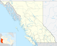
 Charlie LakeLocation of Charlie Lake in British Columbia
 Subdivisions of British Columbia
 Category:British Columbia ·
  Portal:British Columbia ·
  WikiProject:British ColumbiaCategories: