Char Manpura

Char Manpura
Char Manpura
—  Village  —
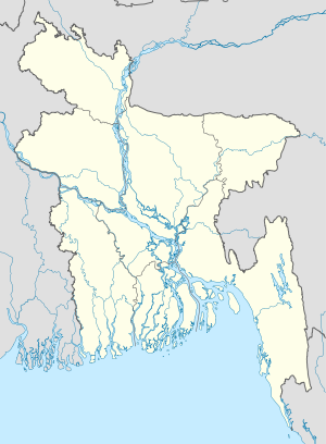
Char Manpura is located in Bangladesh
Char Manpura
Location in Bangladesh
Coordinates: 23°2′N 90°25′E / 23.033°N 90.417°E / 23.033; 90.417Coordinates: 23°2′N 90°25′E / 23.033°N 90.417°E / 23.033; 90.417
Country  Bangladesh
Division Barisal Division
District Barisal District
Time zone Bangladesh Time (UTC+6)

Char Manpura is a village in Barisal District in the Barisal Division of southern-central Bangladesh.[1][2]

References

  1. ^ Parisaṃkhyāna Byuro (2005). Bangladesh Population Census, 2001: Barisal. Bangladesh Bureau of Statistics, Planning Division, Ministry of Planning, Govt. of the People's Republic of Bangladesh. http://books.google.com/books?id=4E6xAAAAIAAJ. Retrieved 18 January 2011. 
  2. ^ Geographic Names, National Geospatial-Intelligence Agency, accessed 18 January 2011


Wikimedia Foundation. 2010.

Игры ⚽ Поможем решить контрольную работу

Look at other dictionaries:

  • Char Fasson Upazila — Charfasson চরফ্যাশন   Upazila   …   Wikipedia

  • Upazilas of Bangladesh — | Politics of BangladeshThe districts of Bangladesh are divided into subdistricts, or upazilas (Bengali উপজেলা upojela ). The upazilas are the lowest level of administrative government in Bangladesh. In 1983, the Local Government Ordinance of… …   Wikipedia

  • Mehendiganj Upazila — Mehendigonj মেহেন্দিগঞ্জ   Upazila   …   Wikipedia

  • Подокруга Бангладеш — Подокруга (upazilas) Бангладеш делятся на подрайоны, называемые Upazila Parishad (UZP), или Thana (бенг. উপজেলা oopojela). Подокруга похожи на деление по графствам в некоторых западных странах. В настоящее время в Бангладеш существует 500… …   Википедия

  • Bhola District — For the devastating tropical cyclone, see 1970 Bhola cyclone. Bhola ভোলা   District   …   Wikipedia

Share the article and excerpts

Direct link
Do a right-click on the link above
and select “Copy Link”