Ceylon, Saskatchewan

Ceylon, Saskatchewan
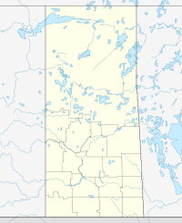
Ceylon is located in Saskatchewan
{{{alt}}}
Ceylon
Location of Ceylon in Saskatchewan

Ceylon is a community in Saskatchewan. A few kilometres to the east of Ceylon, there are sand dunes.

Climate

Climate data for Ceylon
Month Jan Feb Mar Apr May Jun Jul Aug Sep Oct Nov Dec Year
Record high °C (°F) 11
(52)
16
(61)
21
(70)
32
(90)
37
(99)
40
(104)
38.5
(101.3)
40
(104)
36
(97)
32.5
(90.5)
23
(73)
11.5
(52.7)
40
(104)
Average high °C (°F) −7.6
(18.3)
−5.6
(21.9)
1.4
(34.5)
11.1
(52.0)
18
(64)
22.6
(72.7)
25.2
(77.4)
25.2
(77.4)
18.4
(65.1)
11
(52)
0
(32)
−6.9
(19.6)
9.4
Daily mean °C (°F) −12.5
(9.5)
−10.4
(13.3)
−3.5
(25.7)
4.7
(40.5)
11.3
(52.3)
16
(61)
18.6
(65.5)
18.2
(64.8)
11.8
(53.2)
5
(41)
−4.6
(23.7)
−11.8
(10.8)
3.6
Average low °C (°F) −17.4
(0.7)
−15.2
(4.6)
−8.3
(17.1)
−1.7
(28.9)
4.6
(40.3)
9.4
(48.9)
11.8
(53.2)
11.1
(52.0)
5.2
(41.4)
−1
(30)
−9.2
(15.4)
−16.5
(2.3)
−2.3
Record low °C (°F) −38.5
(−37.3)
−41
(−42)
−32
(−26)
−22
(−8)
−7
(19)
−1
(30)
3
(37)
−1.5
(29.3)
−9.5
(14.9)
−19
(−2)
−32.5
(−26.5)
−41
(−42)
−41
(−42)
Precipitation mm (inches) 16
(0.63)
10.9
(0.429)
21.1
(0.831)
23
(0.91)
49.4
(1.945)
65.8
(2.591)
70.5
(2.776)
39.6
(1.559)
37.1
(1.461)
22.1
(0.87)
14.1
(0.555)
16.7
(0.657)
386.3
(15.209)
Source: Environment Canada[1]

References

Coordinates: 49°27′24″N 104°36′22″W / 49.45667°N 104.60611°W / 49.45667; -104.60611


Wikimedia Foundation. 2010.

Игры ⚽ Нужно сделать НИР?

Look at other dictionaries:

  • Saskatchewan Highway 6 — Infobox road province=SK type=Hwy route=6 alternate name= a part of the CanAm Highway maint=Ministry of Highways and Infrastructure Transport Canada length km=516.6 length round=1 length ref= established= direction a= south direction b=north… …   Wikipedia

  • Saskatchewan Highway 377 — Highway 377 is a highway in the Canadian province of Saskatchewan. It runs from Highway 6 near Ceylon to Highway 28 near Radville [ [http://www.esask.ca/search results.html?criteria=weyburn The Encyclopedia of Saskatchewan | Search Results ] ]… …   Wikipedia

  • List of Saskatchewan provincial highways — This is a list of Saskatchewan s highways:Only Highways 1, 2, 6, 7, 11, 12, and 16 contain sections of divided highway. Speed limits range from 90 km/h (55 mph) to 110 km/h (70 mph). Saskatchewan is the only province bordering the United States… …   Wikipedia

  • List of communities in Saskatchewan — Communities of the Province of Saskatchewan, Canada are incorporated towns, cities, villages, and resort villages and unincorporated organized hamlets.[1] Regional rural forms of administration are rural municipalities.[clarification needed]… …   Wikipedia

  • Comunidades en Saskatchewan — Las Comunidades de la provincia de Saskatchewan, Canadá son todas las villas, ciudades, pueblos, incorporados, villas turísticas y aldeas organizadas no incorporadas.[1] Las formas rurales regionales de administración son municipalidades… …   Wikipedia Español

  • Bengough, Saskatchewan — Infobox City official name = Bengough nickname = motto = Gateway to the Big Muddy imagesize = 250px image caption = image mapsize = 250px map caption = mapsize1 = map caption1 = pushpin subdivision type = Country subdivision type1 = Provinces and …   Wikipedia

  • Radville, Saskatchewan — Radville is a small idyllic valley town in southern Saskatchewan, Canada. A small river, Long Creek runs through the north end of the town providing fishing and recreation to the local children and parents. The creek meanders by the east side of… …   Wikipedia

  • HMCS Saskatchewan — Fortune Technisch …   Deutsch Wikipedia

  • Pangman, Saskatchewan — Pangman, formerly known as West Calder , is a village located in southern Saskatchewan, Canada; it is south of Regina. Pangman has a population of 255 and land area of 0.73 square kilometres (2001 census [cite… …   Wikipedia

  • Outline of Canada — The National Flag of Canada …   Wikipedia

Share the article and excerpts

Direct link
Do a right-click on the link above
and select “Copy Link”