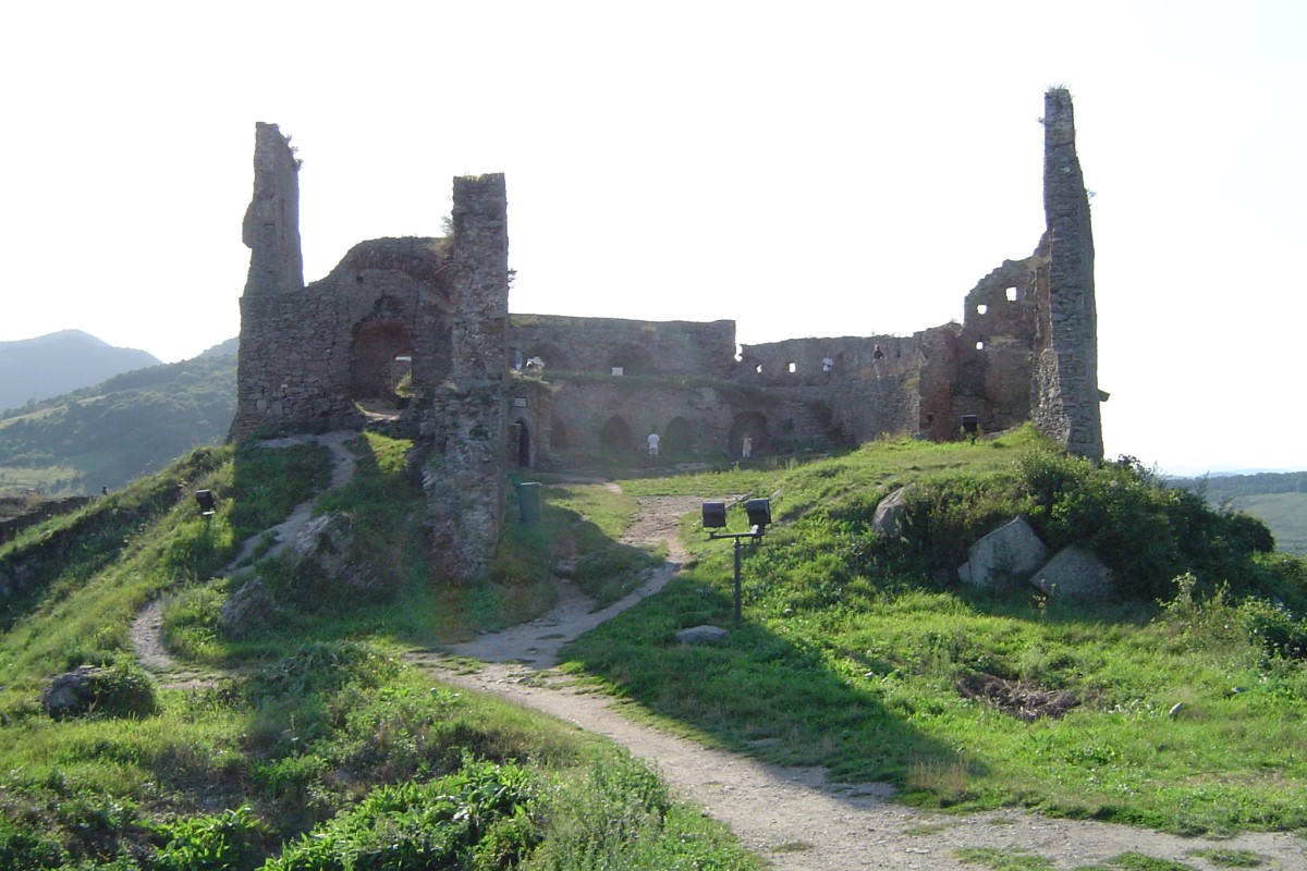
- Fortress of Deva
-
The Fortress of Deva
Cetatea DeveiDeva, Hunedoara County, Romania 
Ruins of The Deva FortressType Fortress Built after 1242 In use 1269–1849 Current
conditionruins in reconstruction Open to
the publicyes Occupants John Hunyadi, Gabriel Bethlen Events magister Petrus Chak defeat The Cumans,
Ferenc Dávid died in the fortress' prison,
Horea, Cloşca and Crişan's revolt besieged (unsuccessfuly) the fortressThe Fortress of Deva, in Romanian: Cetatea Devei, is located in the city of Deva, Hunedoara County, Romania, on top of a volcanic hill.
Position
The Fortress is located on a top of a volcanic hill, one of the last branches of Poiana Ruscă Mountains. From the foot of the hill Deva city spreads out, beginning with Magna Curia and the public park. Nearby are located the lower funicular station (which is used by tourists to reach to fortress), and buildings of the most administrative institutions of the city: The Court House, The Prefecture, The County Hall, The Finance Administration, the old Police headquarters, The City Hall and two of the most oldest schools from Deva: Colegiul Național "Decebal" and Liceul Pedagogic.
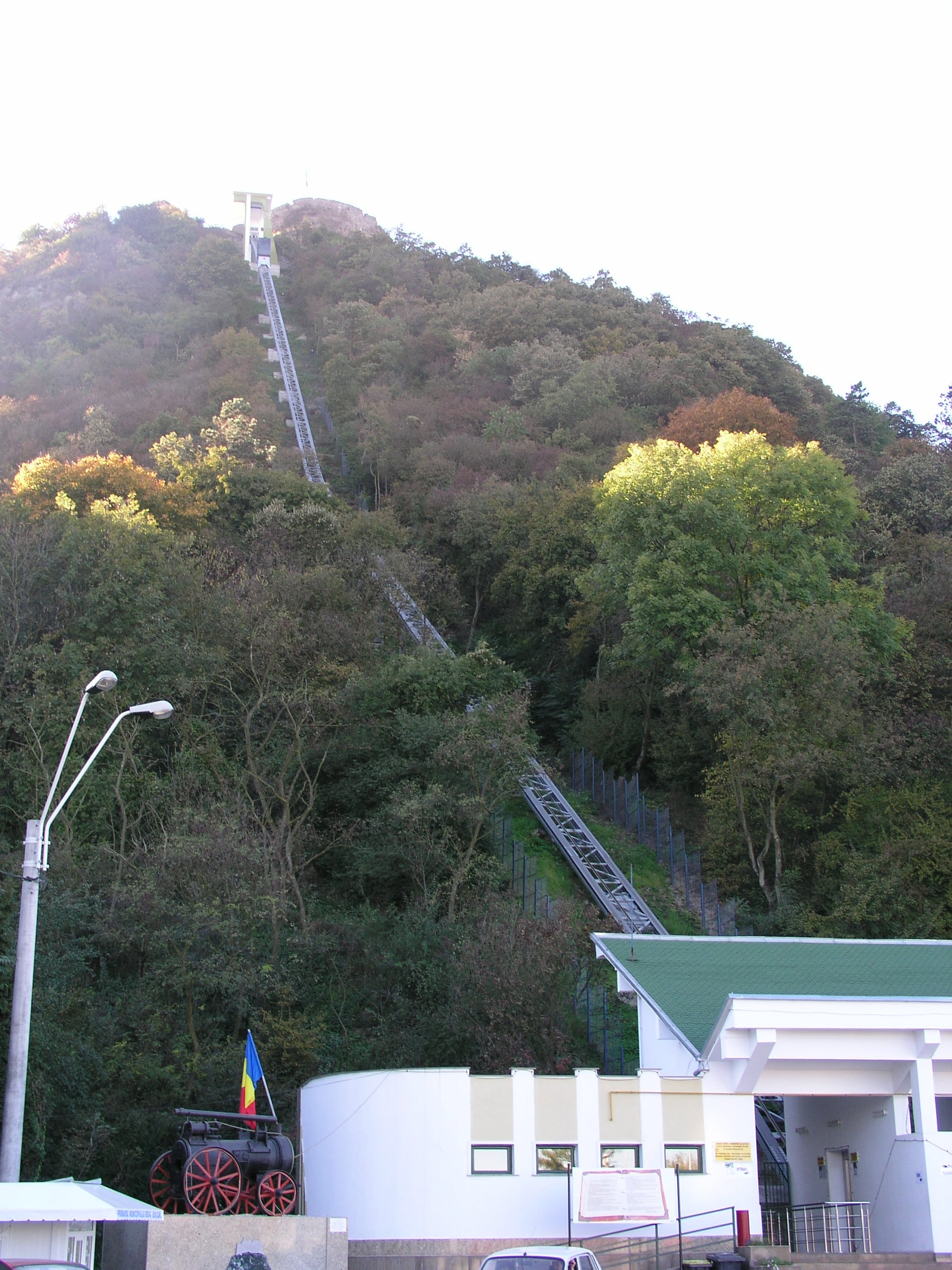
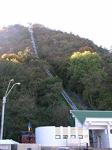 Deva Funicular (inclined railway) provides easy access to the fortress from the city below.
History
The first evidence of the medieval Deva Fortress dates back to the second half of the 13th century, in 1269, when Stephen V, King of Hungary and Duke of Transilvania, mentioned "the royal castle of Deva" in a privilege-grant for the Count Chyl of Kelling (Romanian: comitele Chyl din Câlnic).[1]
From 1273 dates the first record about a military operation that involved The Fortress. Under its walls, the cumans are defeated by Petrus Chak (Latin: Magister Pertrus de genere Chak), who is rewarded for his victory by Ladislaus IV, King of Hungary. In his letter, Ladislaus IV mentioned the facts with the words: sub castro Dewa contra Cumanorum exercitur viriliter dimicavit.[2][3]
At the end of the 13th century, The Deva Fortress is in the property of Ladislaus Kán, Voivode of Transylvania, who organised here a court besides the military garrison.[1]
References
- ^ a b Octavian, Floca; Ben Bassa (1965) (in Romanian). Cetatea Deva. Monumentele patriei noastre. București: Editura Meridiane. pp. 14.
- ^ Octavian, Floca; Ben Bassa (1965) (in Romanian). Cetatea Deva. Monumentele patriei noastre. București: Editura Meridiane. pp. 14. "sub castro Dewa contra Cumanorum exercitur viriliter dimicavit"
- ^ Veszprémy, László. Erik Kooper. ed. Chronicles in Charters. Historical Narratives (narrationes) in Charters as Substitutes for Chronicles in Hungary. pp. p. 194. ISBN 90-420-1875-5. http://books.google.com/books?id=hPM8bExWukIC&pg=PA194&lpg=PA194. Retrieved 2008-08-20. "Magister Pertrus de genere Chak, 1273, In castrum Feketeholm sub castro Deva viriliter dimicavit, quosdam captivando, quosdam perimendo, triumphalem victoriam reportavit;"
Coordinates: 45°53′19″N 22°53′50″E / 45.88861°N 22.89722°E
Categories:- Hunedoara County
- Castles in Romania
- Romanian building and structure stubs
Wikimedia Foundation. 2010.